
The tectonic setting of the Salton Trough
Diagram of the tectonic setting of the Salton Trough.
San Andreas plate boundary system, Gulf of California
download as jpeg download as tiff
The tectonic setting of the Salton Trough
Diagram of the tectonic setting of the Salton Trough.
San Andreas plate boundary system, Gulf of California
download as jpeg download as tiff

Salton Trough/Gulf of California
NASA satellite image of the Gulf of California, including the Salton Trough.
download as jpeg download as tiff

Tectonic diagram of San Andreas transform in Salton Trough
Tectonic diagram of San Andreas transform in Salton Trough, with colorado River system and its fan dam between the Salton Trough and the Gulf of California
fan dam, Colorado River, San Andreas transform, Gulf of California
download as jpeg download as tiff

Southern California seismicity to 1995
A color map of the southern third of California, showing seismicity to 1995.
download as jpeg download as tiff

Probabilities and expected magnitudes of future California earthquakes
A diagram showing the probabilities and magnitudes of future earthquakes in California from 1988 to 2018
download as jpeg download as tiff

Structural framework of the Salton basin
A sketch diagram of the structural framework of the Salton basin.
Salton Sea, San Andreas fault
download as jpeg download as tiff

Gemini satellite view of the Salton Trough.
NASA Satellite photo of the Salton Trough.
Salton Sea, San Andreas fault
download as jpeg download as tiff

Salton basin geology
Geologic map of the Salton Basin
download as jpeg download as tiff

Time stratigraphic chart for Salton Basin
A time stratigraphic chart of the Salton Basin.
Palm Spring Formation, Borrego Formation, Mecca Formation, Canebrake Formation, Brawley Formation, Split Mountain Formation, turbidites
download as jpeg download as tiff

Surface fault traces in Salton Trough
A diagram of surface fault traces in Salton Trough.
San Andreas fault, San Jacinto fault, Salton Sea
download as jpeg download as tiff

Salton Trough detachment
A diagram of the Salton Trough detachment.
San Andreas fault system, Brawley seismic zone, San Jacinto fault, Pacific plate, North American plate
download as jpeg download as tiff

Sea Level in Salton Trough
Sea level marker on Holly Sugar tanks, Imperial Valley, indicating how far below sea level much of Salton Trough is today.
sea level
download as jpeg download as tiff

High stand of Salton Sea near Obsidian Dome
Ground photo of a high stand of Salton Sea near Obsidian Dome.
download as jpeg download as tiff

View across the Salton Sea toward Mecca Hills
View northeast across the Salton Sea to Mecca Hills. Mountains in Joshua Tree National Park on skyline. Differently colored areas in Mecca Hills are different kinds of rocks.
download as jpeg download as tiff

Ancient Lake Cahuilla shoreline
Oblique aerial photo of ancient Lake Cahuilla high stand shoreline etched on metamorphic bedrock at northeast base of Santa Rosa Mountains, and recessive shorelines in sand in the Salton Trough.
lake shorelines
download as jpeg download as tiff

Fan delta
Air photo of a fan delta on the SW side of the Salton Sea.
download as jpeg download as tiff

Oblique aerial view of Split Mountain Canyon
Oblique aerial view of Split Mountain Canyon.
sturtzstrom, debris flow
download as jpeg download as tiff

Stratified alluvial fan deposits
Ground photo of stratified alluvial fan deposits.
Anza Formation, debris flow deposits, conglomerate, breccia, oblique-slip faults
download as jpeg download as tiff

Turbidite sandstone beds folded by stürtzstrom granite breccia
Turbidite sandstone beds folded by stürtzstrom granite breccia.
disharmonic fold, penecontemporaneous fold
download as jpeg download as tiff

Geothermal power plants and rhyolite domes at the south end of the Salton Sea
Oblique aerial view NE, along SE shore of the Salton Sea, showing rhyolite domes (circled in red) and geothermal power plants (red arrows).
rhyolite domes, geothermal power plants
download as jpeg download as tiff

Geothermal power plant
Geothermal power plant at SE end of Salton Sea
geothermal power
download as jpeg download as tiff

Geothermal power plant from Obsidian Hill
Geothermal power plant from Obsidian Hill at SE end of Salton Sea.
geothermal power
download as jpeg download as tiff

Mud volcano
A mud volcano at Imperial Valley. Geologist for scale.
mud volcano
download as jpeg download as tiff

Mudflows from mud volcanoes
Mudflows from mud volcanoes at the south end of the Salton Sea.
download as jpeg download as tiff

Red Hill and New River delta
Aerial view of Red Hill and New River delta in Imperial Valley.
obsidian dome, birdfoot delta
download as jpeg download as tiff

Thematic image Coachella Valley, Salton Sea
Thematic image of Coachella Valley, Salton Sea, Santa Rosa Mountains, Mecca Hills, Joshua Tree National Park
download as jpeg download as tiff

Salton Trough
Diagram of the tectonic arrangement of the Salton Trough, with the Colorado River Delta, faults, crystalline basement outcrops, transforms, spreading ridges, and the Salton Sea.
Salton Sea, San Andreas transform, Colorado River Delta, Cerro Prieto fault.
download as jpeg download as tiff

Right-stepping en echelon folds
Diagram of right-stepping en echelon folds along the San Andreas Fault in the Durmid Hills area.
en echelon folds, strike-slip, San Andreas fault, Salton Trough
download as jpeg download as tiff

Mecca Hills stratigraphy
Diagram of the Mecca Hills stratigraphy.
Ocotillo Formation, Palm Spring Formation, Mecca Formation, Mecca Hills
download as jpeg download as tiff

Oblique aerial view across San Andreas fault
Aerial view across the San Andreas fault in Mecca Hills.
Coachella Valley Canal, Skeleton Canyon fault, San Andreas fault, Painted Canyon
download as jpeg download as tiff

View NW along trace of Skeleton Canyon fault
View NW along trace of Skeleton Canyon fault between Box and Painted Canyons, Mecca Hils, Salton Trough, California.
download as jpeg download as tiff

Partitioned transpression, Mecca Hills, California
Diagram of partitioned transpression as conceived for the structure of the Mecca Hills, Salton Trough, southern California.
partitioned transpression, Mecca Hills, San Andreas fault, Skeleton Canyon fault, Painted Canyon fault
download as jpeg download as tiff

Idealized structure of Painted Canyon fault, Mecca Hills, Salton Trough, southern California.
Idealized structure of Painted Canyon fault, Mecca Hills, Salton Trough, southern California.
transpression, palm tree structure
download as jpeg download as tiff

Idealized cross-sectional geometry of the NW wall of Painted Canyon
Diagram representing an idealized cross-sectional geometry of the NW wall of Painted Canyon, showing footwall structure of Painted Canyon fault, Mecca Hills, Salton Trough, southern California.
download as jpeg download as tiff

Slickensides, Hidden Spring fault, Mecca Hills
Slickensides on Hidden Spring fault surface, upper Box Canyon, Mecca Hills, Salton Trough, southern California. Person shown for scale.
slickensides, slickenlines, strike-slip fault, Mecca Hills
download as jpeg download as tiff

San Andreas fault rocks
Surface expression of the San Andreas fault (red brown rocks) in Skeleton Canyon in the Mecca Hills, Salton Trough, southern California.
San Andreas fault, transpression
download as jpeg download as tiff

Footwall structure of Painted Canyon fault
View SE of footwall structure of Painted Canyon fault on SE wall of Painted Canyon
transpression, palm tree structure, Mecca Hills
download as jpeg download as tiff

Anticline
Anticline in Palm Spring Formation, Box Canyon. Person for scale.
anticline, Box Canyon, Mecca Hills
download as jpeg download as tiff

Painted Canyon fault
Ground photo of Painted Canyon fault. Geologist stands on fault in lower right corner for scale.
Painted Canyon fault, Mecca Hills
download as jpeg download as tiff

Lunch in the Poppyfields
Geologists eating lunch in a poppyfield.
download as jpeg download as tiff

En echelon fractures in clay deformed in left simple shear
Clay model deformation of en echelon fractures formed by left-lateral strike-slip fault motion.
R fractures, popup, strike-slip
download as jpeg download as tiff

Oblique air view SW over Borrego Mountain
An oblique air view SW over Borrego Mountain cut by T fractures within San Jacinto fault zone.
popup structure, transpression, strike-slip fault
download as jpeg download as tiff

En echelon Riedel shears and associated popup
Ground view of en echelon Riedel shears and associated popup formed in asphalt by 1 m right lateral slip on Barbara Worth Road, Imperial Valley.
transpression, restraining stepover
download as jpeg download as tiff

Left stepover
Left-stepping restraining stepover in right-slip earthquake event.
surface faulting, ground rupture, restraining stepover, transpression, strike-slip
download as jpeg download as tiff

Aerial view SE over a restraining stepover
SE aerial view of San Felipe Badlands over a restraining bend in San Jacinto fault zone.
restraining stepover, transpression, popup structure, San Jacinto fault
download as jpeg download as tiff

Clay model of 15 degree convergent right-lateral wrench fault.
Clay model of a 15 degree convergent right-lateral wrench fault. Note vertical separation on the Riedel shears and the strike-slip offset of folds.
transpression
download as jpeg download as tiff

Clay welt
Oblique view of clay welt formed in a 15 degree transpression. Note left-stepping R shears, right en echelon folds.
transpression
download as jpeg download as tiff

Upthrust welt between convergent strike-slip blocks
Diagram of an upthrust welt between convergent strike-slip blocks.
download as jpeg download as tiff

Date palm trees
Date palm tree as geometric illustration of "palm tree structure" in transpressional, strike-slip mechanics
download as jpeg download as tiff

Mecca Hills structure
Diagram of the inferred basement structure of the Mecca Hills.
san Andreas fault, palmtree structure, Painted Canyon fault, popup structure, flower structure
download as jpeg download as tiff

Uplift in transpression
Diagram of transpressive uplift.
popup structure, palm tree structure, flower structure
download as jpeg download as tiff

Oklahoma seismic lines
Locations of Oklahoma seismic lines.
download as jpeg download as tiff

Criner Hills flower structure
Seismic profile of Criner Hills, Oklahome.
flower structure, palmtree structure
download as jpeg download as tiff

Madil anticline
Seismic profile from Madil anticline, southern Oklahoma.
flower structure, palm tree structure, transpression
download as jpeg download as tiff

Deep flower structure at Ardmore basin
Seismic profile at Ardmore Basin showing deep flower structure.
flower structure, palm tree structure, transpression
download as jpeg download as tiff

Palm tree structure
Seismic profile of southern Oklahoma demonstrating palm tree structure.
flower structure, palm tree structure, transpression
download as jpeg download as tiff

Migrated seismic profile across Ardmore basin strike-slip fault
Migrated seismic profile across Ardmore basin strike-slip fault.
flower structure, palm tree structure, transpression
download as jpeg download as tiff

Generalized geologic map of slust-thride
Generalized geologic map of slust-thride
strike-slip fault, transpression, San Andreas fault
download as jpeg download as tiff

Generalized cross-section of thrust slide geometry along a strike-slip fault
Generalized cross-section of thrust-slide geometry along a strike-slip fault.
transpression
download as jpeg download as tiff

Thlides
"Thlides" on strike-slip faults after Wellman, Sharp.
strike-slip fault, Alpine schist, Coahuilla granite, transpression, Alpine fault, San Jacinto fault
download as jpeg download as tiff

Thrust or slust?
Diagram depicting a thrust and slust
transpression
download as jpeg download as tiff

Summary of strike-slip stepovers.
Diagramatic summary of strike-slip stepovers.
popup structure, strike-slip, transpression
download as jpeg download as tiff

Restraining stepover, 30 degree underlap
Clay model representation of a restraining stepover with 30 degree underlap of faults.
popup structure
download as jpeg download as tiff

90 degree neutral stepover
Clay model representation of a 90 degree neutral stepover between en echelong left-lateral strike-slip faults
popup structure
download as jpeg download as tiff

Sections and map diagram, 30 degree underlap
Sections and map diagram of clay model of restraining stepover, with a 30 degree underlap without sedimentation.
pop up structure
download as jpeg download as tiff

Sections and line diagram, exp. 303
Sections and line diagram of pop up without sedimentation in a 90 degree neutral restraining stepover.
download as jpeg download as tiff

Idealized popup in left-slip
Diagram of an idealized popup formed in left-slip.
download as jpeg download as tiff

Echo Hills popup
Diagram of Echo Hills popup.
strike-slip faults
download as jpeg download as tiff

Owl Creek popup
Diagram of Owl Creek popup, Wyoming
strike-slip faults
download as jpeg download as tiff

Quealy popup
Diagram of Quealy popup, Laramie Basin, Wyoming.
strike-slip fault
download as jpeg download as tiff

Strain partitioning
Definition of strain partitioning.
strike-slip faults, transpression
download as jpeg download as tiff
 subduction")
Oblique (partitioned) subduction
Diagram of sinistral oblique (partitioned) subduction.
transpression, strike-slip fault
download as jpeg download as tiff

Plate motion
Diagram of plate motion between Australian and Pacific plates in New Zealand.
strike-slip fault, transform, plates, transpression
download as jpeg download as tiff

Strain partitioning: New Zealand
Diagram of strain partitioning.
strike-slip, transform, faults, transpression
download as jpeg download as tiff

Andaman Sea tectonics
Diagram of tectonics at the Andaman Sea, Burma.
Oblique subduction, Chindwin fault, Sumatra, transpression
download as jpeg download as tiff

Los Angeles basin focal mechanism
Los Angeles basin focal mechanisms, showing strike-slip and thrust mechanisms.
strain partitioning, strike-slip
download as jpeg download as tiff

Caldwell Lake on San Andreas fault
Ground photo of Caldwell Lake (arrow) on the San Andreas fault.
sag pond, strike-slip fault, San Andreas fault
download as jpeg download as tiff

Ridges and fault scarps in San Andreas fault zone
Ridges and fault scarps in San Andreas fault zone.
San Andreas fault, tectonic geomorphology
download as jpeg download as tiff

The 1960 Chilean earthquake epicenters superposed on California map outline
The 1960 Chilean earthquake epicenters superposed on California map outline.
San Andreas fault
download as jpeg download as tiff

Sag pond and pressure ridge - San Andreas fault zone
Ground photo of the San Andreas fault zone at Lamont Odet Vista Point near Palmdale, with Lake Palmdale (artificially enlarged sag pond), and elongate pressure ridge (beneath arrow).
San Andreas fault
download as jpeg download as tiff

Cajon Creek with inface bluffs on skyline
Cajon Creek with inface bluffs on the skyline; Morman Rocks area.
San Andreas fault, headward erosion, stream piracy
download as jpeg download as tiff

Air view of fault ridges
Air view of fault ridges. The most prominent is 1857.
San Andreas fault
download as jpeg download as tiff
")
*UNTITLED* (fault histories)
Fault histories of the central Transverse Ranges.
San Andreas fault
download as jpeg download as tiff

San Andreas rift zone
Ground photo of a mudflow in the San Andreas rift zone.
San Andreas fault, mudflow
download as jpeg download as tiff
")
*UNTITLED*(fault histories)
Fault histories of the central transverse ranges.
San Andreas fault
download as jpeg download as tiff

Why are the rocks different on either side of the fault?
Diagram showing why rocks are different on either side of the San Andreas fault.
San Andreas fault
download as jpeg download as tiff

Southern California uplift
Diagram of Southern California uplift.
Palmdale bulge, San Andreas fault
download as jpeg download as tiff

San Andreas mobile zone
Diagram of the San Andreas mobile zone.
San Andreas fault, plate boundary, transform
download as jpeg download as tiff

View SE across Salt Creek along crest of Durmid Hills
View SE across Salt Creek along crest of Durmid Hills with San Andreas fault.
Palm Spring Formation, San Andreas fault, ancient Lake Cahuilla, Bat Caves Butte
download as jpeg download as tiff

Durmid folds
Air photo of Durmid folds.
ancient Lake Cahuilla floor, folded strata, San Andreas fault
download as jpeg download as tiff

Oblique Air View NW Across Durmid Hills
Aerial view NW across San Andreas fault over Durmid Hills with Bat Caves Butte
San Andreas fault
download as jpeg download as tiff

Durmid folds
Aerial photo of Durmid folds and eroded floor of ancient Lake Cahuilla.
folded strata, ancient lake beds, San Andreas fault
download as jpeg download as tiff

Durmid folds
Aerial view of Durmid folds in eroded floor of ancient Lake Cahuilla
folded strata, eroded floor of ancient Lake Cahuilla, San Andreas fault
download as jpeg download as tiff

Durmid folds
Oblique aerial view of Durmid folds.
folded strata, eroded floor of ancient Lake Cahuilla, San Andreas fault
download as jpeg download as tiff

Durmid folds and San Andreas fault
Oblique erial photo of Durmid folds on eroded floor of ancient Lake Cahuilla, adjacent to San Andreas fault.
folded strata, en echelon folds, San Andreas fault
download as jpeg download as tiff

San Andreas fault and Bat Caves Buttes in Durmid Hills
Oblique air photo of the San Andreas fault and Bat Caves Buttes, view NW.
eroded floor of ancient Lake Cahuilla, San Andreas fault
download as jpeg download as tiff

Salt Creek, Bat Caves Buttes, San Andreas fault
View SE across Salt Creek along the San Andreas fault between Bat Caves Buttes and eroded floor of ancient Lake Cahuilla.
San Andreas fault
download as jpeg download as tiff

View SE down San Andreas fault at Salt Creek.
View SE down the San Andreas fault at Salt Creek, between Bat Caves Buttes in Durmid Hills and eroded floor of ancient Lake Cahuilla.
San Andreas fault
download as jpeg download as tiff

View N across San Andreas fault where it crosses Salt Creek.
A view N across the San Andreas fault where it crosses Salt Creek.
San Andreas fault
download as jpeg download as tiff

Oblique aerial view of Bat Caves Buttes with San Andreas fault
Oblique aerial view of Bat Caves Buttes at Salt Creek.
San Andreas fault
download as jpeg download as tiff

Oblique Air View West over En Echelon Folds in Durmid Hills
Oblique air view West over en echelon folds in Durmid Hills.
en echelon folds, folding, San Andreas fault
download as jpeg download as tiff

Durmid Hills Leveling Array
Durmid Hills leveling array diagram.
leveling array, tectonic geodesy, San Andreas fault
download as jpeg download as tiff

Oblique Air View NW Across Bat Caves Buttes in Durmid Hills
An oblique air view NW across Durmid Hills and San Andreas fault with Bat Caves Buttes and eroded floor of ancient Lake Cahuilla
San Andreas fault
download as jpeg download as tiff

Oblique Air View West Across San Andreas Fault, En Echelon Folds
An oblique air view West across the San Andreas fault and en echelon folds
en echelon folds, folding, fault, faulting, San Andreas fault
download as jpeg download as tiff

Oblique Aerial View SE Over Bombay Beach and Salton Sea Shore
An oblique aerial view SE over Bombay Beach and the Salton Sea shore adjacent to eroded floor of Lake Cahuilla.
Bombay Beach, shorelines, lakes, San Andreas fault
download as jpeg download as tiff

Oblique Aerial View of Bat Caves Buttes
An oblique aerial view of Bat Caves Buttes, San Andreas fault, ancient Lake Cahuilla shorelines.
shorelines, fault, San Andreas fault
download as jpeg download as tiff

Oblique Aerial View of Bat Cave Buttes and San Andreas fault
An oblique aerial view of Bat Cave Buttes and San Andreas fault
shorelines, fault, ancient Lake Cahuilla, San Andreas fault
download as jpeg download as tiff

Bat Caves Leveling 1987-1988
Bat Caves Leveling from 1987 to 1988.
leveling,caves, San Andreas fault
download as jpeg download as tiff

Durmid Folds
Oblique air photo of Durmid folds and eroded floor of ancient Lake Cahuilla.
folds, folding, ancient Lake Cahuilla, San Andreas fault
download as jpeg download as tiff

Oblique Air View NW Along San Andreas Fault
An oblique air view NW along San Andreas Fault, Durmid Hills, Durmid folds, eroded floor of ancient Lake Cahuillaaugmented Description.
faults, faulting, en echelon folds, San Andreas fault
download as jpeg download as tiff

Oblique Air View West Across Durmid Hills and San Andreas Fault
An oblique air view West across Durmid Hills, San Andreas fault, and part of Salton Sea.
faults, faulting, en echelon folds, strike-slipSan Andreas fault
download as jpeg download as tiff

Durmid Hills
oblique air photo of big fold southeast of Durmid Hills
folds, folding, San Andreas fault
download as jpeg download as tiff

Durmid Hills Folds adjacent to San Andreas Fault
Oblique air photo of Durmid Hills folds adjacent to San Andreas fault.
folds, folding, strike-slip fault, en echelon folds, San Andreas fault
download as jpeg download as tiff

View NE of Beveled Folds and Dendritic Drainage
View NE at beveled folds and dendritic drainage on floor of ancient Lake Cahuilla.
beveled folds, dendritic drainage, folding, San Andreas fault
download as jpeg download as tiff

Folds Adjacent to San Andreas Fault
Oblique air photo of folds adjacent to the San Andreas fault.
en echelon folds, folding, faults, strike-slip faulting, San Andreas fault
download as jpeg download as tiff

Durmid Folds
Oblique air photo of Durmid folds.
folds, folding, San Andreas fault
download as jpeg download as tiff

Crest of Durmid Hill
Ground photo SW across San Andreas fault to Salton Sea from the crest of Durmid Hill.
San Andreas fault, San Andreas fault
download as jpeg download as tiff

Crest of Durmid Hill
Plio-Pleistocene lacustrine strata of Palm Spring Formation at the crest of Bat Caves Buttes, Durmid Hills
Palm Spring Formation, lacustrine strata, San Andreas fault
download as jpeg download as tiff

Durmid Hill from Salton Sea Shore
Ground photo across San Andreas fault of Durmid Hill from the Salton Sea shore. Students are performing a leveling survey across the fault and the hill.
leveling, San Andreas fault
download as jpeg download as tiff

Durmid Hill-View from Salton Sea Shore
View from the Salton Sea Shore of Durmid Hill.
San Andreas fault
download as jpeg download as tiff

Orocopia Schist basement in upper Painted Canyon
Oblique air photo of Orocopia Schist basement overlain by Palm Spring and Ocotillo formations in upper Painted Canyon, Mecca Hills.
schist, Orocopia Formation, San Andreas fault
download as jpeg download as tiff

View SE along Mecca Hills fault toward Mecca Hills
Oblique aerial view SE along the Mecca Hills fault across Mecca toward Salton Sea. Photo taken from above Thermal Canyon.
fault, popup structure, transpression, San Andreas fault
download as jpeg download as tiff

View NW along trace of the San Andreas fault
Oblique aerial view NW along trace of "San Andreas" fault zone.
transpression, fault, faulting, popup structure, San Andreas fault
download as jpeg download as tiff

Oblique air view NW of central Mecca Hills
An oblique air view NW of Painted Canyon fault, central Mecca Hills.
transpression, fault, faulting, popup structure, San Andreas fault
download as jpeg download as tiff

View NW at Mecca Hill and
Oblique aerial view NW at Mecca Hill and into Mecca anticline which forms a popup structure between San Andreas and Painted Canyon faults.
anticline, popup structure, transpression, fold, folding, San Andreas fault
download as jpeg download as tiff

Thematic image of Coachella Valley and Joshua Tree National Monument
Thematic image of Coachella Valley and Joshua Tree National Monument.
San Andreas fault, Coachella Valley, Indio Hills, Mecca Hills, San Andreas fault
download as jpeg download as tiff

View west, SE end of Indio Hills, Banning fault
Folded beds and the trace of Banning fault.
San Andreas fault system, fault, faulting, San Andreas fault
download as jpeg download as tiff

View NW at an angle to Eagle Canyon fault scarp
Oblique aerial view NW at an angle to Eagle Canyon fault scarp at Mecca Hills.
fault, faulting, transpression, San Andreas fault
download as jpeg download as tiff

View NW into roll-over fold SW of Mecca anticline
Oblique aerial view NW into a overturned fold on SW flank of Mecca anticline, 2 km NW of Painted Canyon.
transpression, popup structure, anticline, fold, folding, San Andreas fault
download as jpeg download as tiff

View SE along San Andreas fault
Oblique aerial view SE along the San Andreas fault.
transpression, popup structure, fault, faulting, syncline, San Andreas fault
download as jpeg download as tiff

Painted Canyon fault between Box and Painted Canyons
The Painted Canyon fault between Box and Painted Canyons.
San Andreas fault
download as jpeg download as tiff

View NW along trace of Painted Canyon faulton NE side of Mecca anticline
Oblique aerial view NW along the a trace of Painted Canyon fault on NE flank of Mecca anticline.
transpression, popup structure, fault, faulting, San Andreas fault
download as jpeg download as tiff

Mecca Hills oblique aerial view
An oblique aerial view of Mecca Hills with Joshua Tree National Park in the background.
transpression, popup structure, fault, faulting, San Andreas fault
download as jpeg download as tiff

View NW along trace of San Andreas fault
A view NW along "San Andreas" fault at Red Canyon, NW end of Mecca Hills.
transpression, fault, faulting, San Andreas fault
download as jpeg download as tiff

View west of folds under the San Andreas fault
A view west of the folds under the "San Andreas" thrust flap east of the mouth of Painted Canyon.
transpression, en echelon folds, fault, faulting, San Andreas fault
download as jpeg download as tiff

View NE across Mecca Hills up Painted Canyon
A view NE across Mecca Hills up Painted Canyon.
transpression, popup structure, fault, faulting, San Andreas fault, alluvial fan
download as jpeg download as tiff

View SW at folded beds under thrust flap east of mouth of Painted Canyon
Aerial view SW at some folded beds under a thrust flap east of the mouth of Painted Canyon.
transpression, fault, faulting, folds, folding, San Andreas fault
download as jpeg download as tiff

View NW along Mecca Hills fault
Aerial view NW along Mecca Hills fault. Note the cross fault outlining uplift and the wedge-shaped block underlying Mecca Hill.
transpression, fault, faulting, popup structure, San Andreas fault
download as jpeg download as tiff

View SW at Painted Canyon knot, Mecca Hills fault, basement corner
Aerial view SW across Painted Canyon fault at central block with basement corner overlain by Mecca Formation fold into Mecca anticline.
transpression, popup structure, faults, faulting, fold, folding, San Andreas fault
download as jpeg download as tiff

View NE across north end of Salton Sea from Travertine Rock
A view NE across the north end of the Salton Sea toward Mecca Hills, taken from Travertine Rock.
stsrike-slip basin, San Andreas fault
download as jpeg download as tiff

Oblique air view NW of Painted Canyon fault in Painted Canyon
An oblique air view NW along Painted Canyon fault, which separates the central and platform blocks in the Mecca Hills. Basement outcrop and thrust flaps also shown.
transpression, popup structure, faults, faulting, San Andreas fault
download as jpeg download as tiff

Oblique air view W into Painted Canyon knot
An oblique air view W of Painted Canyon fault, basement overlain by nonconformable Mecca Formation in central block, thrust flaps on edge of platform block
transpression, popup structure, faults, faulting, San Andreas fault
download as jpeg download as tiff

Oblique air view W into Painted Canyon knot
An oblique air view W of Painted Canyon fault, thrust flaps on edge of platform block, basement and folded Mecca Formation in central block
transpression, popup structure, flower structure, palmtree structure, faults, faulting, folds, San Andreas fault
download as jpeg download as tiff

Oblique air view NW along axis of Mecca Hills
An oblique air view NW along Painted Canyon fault where it crosses Painted Canyon, with basement, folded Mecca Formation in central block, thrust flaps on edge of platform block
transpression, popup structure, flower structure, palmtree structure, fault, faulting, San Andreas fault
download as jpeg download as tiff

Painted Canyon knot
Air view of Painted Canyon fault between central and platform blocks in tributary NW of Painted Canyon
San Andreas fault
download as jpeg download as tiff

Oblique air view SE along San Andreas fault
An oblique air view SE along the San Andreas and Skeleton Canyon faults between Thermal (beneath photographer and Painted Canyon in distance at top of image, Mecca Hills.
fault, faulting, strike-slip faulting San Andreas fault
download as jpeg download as tiff

Down plunge view of Painted Canyon knot
A down plunge view of Painted Canyon fault, basement, nonconformable Mecca Formation on central block, and Art's Hill thrust flap on edge of platform block.
transpression, popup structure, palmtree structure, faults, faulting, anticline, fold, folding, San Andreas fault
download as jpeg download as tiff

View SE along San Andreas fault
A view SE along the San Andreas fault.
strike-slip faultSan Andreas fault
download as jpeg download as tiff

San Andreas fault aquaclude SE of Mecca Hills
The San Andreas fault, North Shore, SE of Mecca Hills.
strike-slip fault, aquaclude, San Andreas fault, vegetation line
download as jpeg download as tiff

San Andreas fault at North Shore
The San Andreas fault, North Shore, SE of Mecca Hills.
strike-slip fault, aquaclude, San Andreas fault, vegetation lineament
download as jpeg download as tiff

Regional interpretation of thematic image
Regional interpretation of a thematic image of Mecca Hills region.
San andreas fault system, San Andreas fault
download as jpeg download as tiff

Oblique aerial view NW along San Andreas fault
Oblique aerial view NW along the San Andreas and Skeleton Canyon faults, NW of Painted Canyon.
strike-slip fault, San Andreas fault
download as jpeg download as tiff

NW along San Andreas fault in Red Canyon area
Oblique aerial view NW along the San Andreas fault in the Red Canyon area.
strike-slip fault, San Andreas fault
download as jpeg download as tiff

Oblique air view NW of San Andreas fault
An oblique air view NW of the San Andreas fault along southwest side of southeastern Indio Hills.
strike-slip fault, San Andreas fault, aquaclude, vegetation lineament
download as jpeg download as tiff

View NW along Mecca Hills fault at Painted Canyon knot
Oblique aerial view NW along the Painted Canyon fault adjacent to Painted Canyon.
transpression, popup structure, palmtree structure, flower structure, fault, faulting, anticline, San Andreas fault
download as jpeg download as tiff

WSW into Red Canyon
A view WSW into Red Canyon.
San Andreas fault, transpression, popup structure, palmtree structure
download as jpeg download as tiff

San Andreas fault NW of Painted Canyon
Oblique aerial view of the San Andreas and Skeleton Canyon faults, NW of Painted Canyon.
transpression, popup structure, palmtree structure, flower structure, fault, strike-slip faulting, San Andreas fault
download as jpeg download as tiff

View S down Painted Canyon
Oblique aerial view S down Painted Canyon. View is across the Painted Canyon and San Andreas faults that bound the uplifted central block between the basin block and the platform block of the palmtree structure
transpression, palmtree structure, flower structure, popup structure, faults, strike-slip faulting, San Andreas fault
download as jpeg download as tiff

Tight folds against Painted Canyon fault
Oblique aerial view NW of tight folds against Painted Canyon fault.
transpression, flower structure, palmtree structure, fault, strike-slip faulting, San Andreas fault
download as jpeg download as tiff

Oblique aerial view NW along San Andreas fault
An oblique aerial view NW along the San Andreas at the northwest end of the Mecca Hills.
strike-slip fault, transpression, San Andreas fault
download as jpeg download as tiff

Oblique air view NW of NW Mecca Hills
An oblique air view NW of NW Mecca Hills.
San Andreas fault
download as jpeg download as tiff

NE, up Painted Canyon
Oblique aerial view NE, up Painted Canyon, across central Mecca Hills with central block and platform block.
transpression, popup structure, flower structure, palmtree structure, faults, faulting, San Andreas fault
download as jpeg download as tiff

Oblique air view NW along Painted Canyon fault
An oblique air view NW along the Painted Canyon fault southeast of Box Canyon. Other unnamed faults are dashed.
strike-slip faults, faulting, transpression, badlands, San Andreas fault
download as jpeg download as tiff

Oblique air view NW along Painted Canyon fault
An oblique air view NW along the Painted Canyon fault, southeast of Box Canyon.
faults, faulting, badlands, San Andreas fault
download as jpeg download as tiff

Oblique air view NW of SW edge of Mecca Hills
An oblique air view NW of the SW edge of Mecca Hills, with the San Andreas fault, Skeleton Canyon fault, Skeleton Canyon syncline, basin and central blocks.
transpression, popup structure, palmtree structure, flower structure, faults, faulting, syncline, San Andreas fault
download as jpeg download as tiff

Oblique air view W across central Mecca Hills
An oblique air view W across central Mecca Hills with Painted Canyon fault and Mecca anticline.
transpression, popup structure, flower structure, palmtree structure, faults, faulting, San Andreas fault
download as jpeg download as tiff

View SE along trace of Banning-Mission Creek fault
Oblique aerial view SE along the trace of Banning-Mission Creek fault.
strike-slip fault, faulting, San Andreas fault
download as jpeg download as tiff

Looking SE along trace of Banning fault from Indio Hills toward Orocopia Mountains
Looking SE along the trace of Banning fault from Indio Hills toward the Orocopia Mountains in the misty distance.
San Andreas fault
download as jpeg download as tiff

View SE along trace of Banning-Mission Creek fault from Indio Hills to Mecca Hills
Oblique aerial view SE along the trace of Banning-Mission Creek fault from Indio Hills to Mecca Hills in the misty distance.
San Andreas fault
download as jpeg download as tiff

Folds in Tertiary rocks of Indio Hills
Aerial view of folds in the Tertiary strata of Indio Hills.
San Andreas fault
download as jpeg download as tiff

View SE along trace of Banning-Mission Creek fault
Oblique aerial view SE along the trace of Banning-Mission Creek fault, from Indio Hills to Mecca Hills.
San Andreas fault
download as jpeg download as tiff

View NW along axis of Indio Hills
Oblique aeria view NW along the axis of Indio Hills.
San Andreas fault system, Mission Creek fault, San Andreas fault
download as jpeg download as tiff

View W, southeast end of Indio Hills
Oblique aerial view W of folds and the trace of Banning-Mission Creek fault in the Indio Hills.
faults, strike-slip faulting, folds, San Andreas fault
download as jpeg download as tiff

View west, southeast end of Indio Hills
Oblique aerial view W across southeast end of Indio Hill. Note the folds, and the trace of Banning fault.
San Andreas fault system, folds, folding, faults, faulting, San Andreas fault
download as jpeg download as tiff

View NW, SE end of Indio Hills
Oblique aerial view NW along the southern Indio Hills.
San Andreas fault system, faults, faulting, badlands topography, San Andreas fault
download as jpeg download as tiff

View NW along trace of Banning fault
Oblique aerial view NW along the trace of the Banning fault. Mt. San Gorgonio in the rear.
San Andreas fault system, groundwater aquaclude, San Andreas fault
download as jpeg download as tiff

View NW along trace of Banning fault
Oblique aerial view NW along the trace of the Banning fault in the Indio Hills.
San Andreas fault system, San Andreas fault
download as jpeg download as tiff

View NW across Mission Creek fault at Thousand Palms Canyon
Oblique aerial view NW across the Mission Creek fault at Thousand Palms Canyon and up the length of the Indio Hills.
San Andreas fault
download as jpeg download as tiff

Biskra Palms Oasis
Biskra Palms oasis on Banning fault with Washingtonia filifera native palm trees at mouth of Thousand Palms Canyon.
oasis, Banning fault, aquaclude, ground water barrier, San Andreas fault
download as jpeg download as tiff

View NW along trace of Banning fault toward Mt. San Gorgonio
Oblique aerial view NW along the trace of the Banning fault toward Mt. San Gorgonio.
San Andreas fault system, fault, faulting, San Andreas fault
download as jpeg download as tiff

View NW along trace of Banning fault
Oblique aerial view NW along the trace of the Banning fault, which forms a groundwater barrier in the subsurface. Mt. San Gorgonio on skyline.
aquaclude, San Andreas fault
download as jpeg download as tiff

Proliferation of vegetation by water damming along Banning fault
Oblique aerial view SW of proliferation of native palm trees by subsurface water damming (aquaclude) along the Banning fault.
aquaclude, San Andreas fault
download as jpeg download as tiff

View south across Thousand Palms Oasis and Mission Creek fault
Oblique aerial view south across the Thousand Palms Oasis, at the Mission Creek fault zone.
aquaclude, fault, faulting, San Andreas fault
download as jpeg download as tiff

View SE along Banning fault toward Mecca Hills at SE Indio Hills
Oblique aerial view SE of Indio Hills along the Banning fault. Mecca Hills on skyline.
fault, faulting, sand and gravel quarry, San Andreas fault
download as jpeg download as tiff

View NE across oasis on Banning fault
Oblique aerial view NE across a palm tree oasis on Banning fault near Pushawalla Canyon.
aquaclude, fault, faulting, San Andreas fault
download as jpeg download as tiff

Mission Creek fault crossing Thousand Palms Canyon
Oblique aerial view SW of Mission Creek fault crossing Thousand Palms Canyon.
oasis, aquaclude, fault, faulting, San Andreas fault
download as jpeg download as tiff

Mission Creek fault
Oblique aerial view south of Mission Creek fault where it crosses Thousand Palms Canyon and goes through Thousand Palms oasis.
Oasis, fault, faulting, aquaclude, San Andreas fault
download as jpeg download as tiff

Banning fault aquaclude and oases
Oblique aerial view north of Banning fault and palm tree oases behind aquaclude near Pushawalla Canyon
oasis, aquaclude, fault, faulting, San Andreas fault
download as jpeg download as tiff

View NW along trace of Banning fault at Willis Palms
A view NW along the trace of the Banning fault at Willis Palms, Indio Hills. Palms are the native Washingtonia filifera; other vegetation is mesquite.
oasis, aquaclude, fault, San Andreas fault
download as jpeg download as tiff

View SW across oasis on Banning fault
Oblique aerial view SW across an oasis on the Banning fault at the mouth of Thousand Palms Canyon..
oasis, aquaclude, fault, faulting, San Andreas fault
download as jpeg download as tiff

View W across NW Indio Hills
Oblique aerial view W across the NW Indio Hills.
badlands topography, dipping strata, San Andreas fault
download as jpeg download as tiff

View W across Mission Creek fault and NW Indio Hills
Oblique aerial view W across the Mission Creek fault and NW Indio Hills.
fault, faulting, San Andreas fault
download as jpeg download as tiff

Offset alluvial fan
Oblique aerial view North of beheaded alluvial fan that has been displaced right-laterally along the Banning fault.
strike-slip faulting, faults, San Andreas fault
download as jpeg download as tiff

Broad folds
Oblique aerial view NW of folded Plio-Pleistocene strata between Banning and Mission Creek faults
folds, folding, faults, faulting, badlands topography, San Andreas fault
download as jpeg download as tiff

Broad folds
Oblique aerial view NW of folded Plio-Pleistocene strata between Banning and Mission Creek faults, Indio Hills
transpression, faults, faulting, strike-slip, badlands topography, palmtree structure, flower structure, en echelon folds, San Andreas fault
download as jpeg download as tiff

Oblique air view into folds in Indio Hills
An oblique air view into en echelon folds in Plio-Pleistocene strata in the Indio Hills.
transpression, en echelon folds, faults, faulting, palmtree structure, flower structure, San Andreas fault
download as jpeg download as tiff

Oblique air view NW into folds at Indio Hills
An oblique air view NW into en echelon folds alongside the Banning fault, Indio Hills.
transpression, San Andreas fault system, palmtree structure, flower structure, faults, faulting, strike-slip, San Andreas fault
download as jpeg download as tiff

Oblique air view NW along the Banning fault
An oblique air view NW along the Banning fault. Vegetation grows along fault
aquaclude, badlands topography, fault, faulting, San Andreas fault
download as jpeg download as tiff

View SE along Banning fault
Oblique aerial view SE along the Banning fault.
faults, faulting, San Andreas fault
download as jpeg download as tiff

Oblique aerial view WNW across Banning fault at Indio Quarry
An oblique aerial view WNW across the Banning fault at Indio Quarry, with beheaded, right laterally displaced alluvial fan.
strike-slip fault, faulting, badlands topography, San Andreas fault
download as jpeg download as tiff

Aerial view of Mission Creek fault
Oblique aerial view NE of the Mission Creek fault at Thousand Palms Oasis.
oasis, aquaclude, fault, faulting, San Andreas fault
download as jpeg download as tiff

Oblique aerial view of Mission Creek fault
An oblique aerial view South of the Mission Creek fault and Thousand Palms Oasis.
aquaclude, oasis, fault, faulting, San Andreas fault
download as jpeg download as tiff

Oblique air view NW of NW Mecca Hills
An oblique air view NW of NW Mecca Hills with San Andreas and Skeleton Canyon faults, basin and central blocks, Mecca anticline.
transpression, popup structure, palmtree structure, flower structure, faults, faulting, strike-slip, anticline, San Andreas fault
download as jpeg download as tiff

Biskra Palms
view downstream of an oasis of native palm trees at the mouth of a small canyon that debouches on the trace of the Banning fault
oasis, aquaclude, San Andreas fault
download as jpeg download as tiff

Willis Palms
aerial view of Willis Palm oasis on Banning fault
oasis, aquaclude, San Andreas fault
download as jpeg download as tiff

View SE along trace of Banning fault
A view SE along the trace of the Banning fault at Biskra Palms.
aquaclude, oasis, fault scarp, San Andreas fault
download as jpeg download as tiff

Biskra Palms on Banning fault
Biskra Palms on the Banning fault.
oasis, aquaclude, fault scarp, San Andreas fault
download as jpeg download as tiff

Aerial view NW along Banning fault
Aerial view NW along the Banning fault at Pushawalla Canyon.
San Andreas fault
download as jpeg download as tiff

Oblique aerial view NW along Banning fault
An oblique aerial view NW along the Banning fault; shows right lateral strike-slip of canyon of about 1 km.
right lateral strike-slip fault, oasis, aquaclude, San Andreas fault
download as jpeg download as tiff

Oasis on Banning fault
Aerial view N of oasis on Banning fault in Pushawalla Canyon..
oasis, aquaclude, right lateral strike-slip fault, San Andreas fault
download as jpeg download as tiff

Pushawalla Canyon
Oblique aerial view SW across Banning fault in Indio Hills where it displaces Pushawalla Canyon right laterally about 1 km
right lateral strike-slip fault, San Andreas fault
download as jpeg download as tiff

Pushawalla Canyon
Oblique aerial view SW across Banning fault in Indio Hills where it displaces Pushawalla Canyon right laterally about 1 km
right lateral strike-slip fault, San Andreas fault
download as jpeg download as tiff

Oblique air view NW along Banning fault
An oblique air view NW along the Banning fault where Pushawalla Canyon is right-laterally displaced about 1 km. Thousand Palms oasis is also in picture.
oasis, aquaclude, right-lateral strike-slip fault, San Andreas fault
download as jpeg download as tiff

Oblique air view SE along Banning fault
An oblique air view SE along the Banning fault.
right lateral strike-slip fault, gravel quarry, San Andreas fault
download as jpeg download as tiff

Broad folds
Oblique aerial view of folds in Plio-Pleistocene, nonmarine strata of the Palm Spring Formation
folds, folding, anticline, syncline, San Andreas fault
download as jpeg download as tiff

Broad folds
Oblique aerial view of folded, Plio-Pleistocene, nonmarine strata of Palm Spring Formation in Indio Hills.
anticline, syncline, folds, San Andreas fault
download as jpeg download as tiff

Groundwater barrier
Oblique aerial view of ground water barrier along Banning fault near Desert Hot Springs
oasis, aquaclude, San Andreas fault
download as jpeg download as tiff

Groundwater barrier
Oblique aerial view of vegetation line along Banning fault
oasis, aquaclude, ground water barrier, San Andreas fault
download as jpeg download as tiff

Groundwater barrier
Oblique aerial view of aligned vegetation along Banning fault
oasis, aquaclude, ground water barrier, San Andreas fault
download as jpeg download as tiff

Oblique aerial view S across Banning fault
Oblique aerial view south across Banning fault, Coachella Valley
Banning fault, aligned vegetation, aquaclude
download as jpeg download as tiff

Oblique air view NW along Mission Creek fault
Oblique aerial view NW along Mission Creek fault
aligned vegetation, aquaclude, groundwater barrier, San Andreas fault
download as jpeg download as tiff

Oblique air view NW along Mission Creek fault
Oblique aerial view NW along Mission Creek fault near Miracle Hill and in Desert Hot Springs
ground water barrier, aquaclude, strike-slip fault, San Andreas fault
download as jpeg download as tiff

View SE along Banning fault toward Indio Hills
Oblique aerial view SE along Banning fault toward, Edom Hill, Mecca Hill, and Orocopia Mountains
aquaclude, groundwater barrier, oasis, San Andreas fault
download as jpeg download as tiff

Mission Creek fault at base of Miracle Hill
Oblique aerial view of Mission Creek fault at base of Miracle Hill near Desert Hot Springs
fault scarp, strike-slip fault, San Andreas fault
download as jpeg download as tiff

Mission Creek fault at Miracle Hill
Oblique aerial view NW of Mission Creek fault at base of Miracle Hill near Desert Hot Springs
fault scarp, strike-slip fault, San Andreas fault
download as jpeg download as tiff

View ENE toward Desert Hot Springs and groundwater barrier on Mission Creek fault
Mission Creek fault in Descrt Hot Springs
groundwater barrier, aquaclude, San Andreas fault
download as jpeg download as tiff

Groundwater barrier on Banning fault
Oblique aerial photo eastward of Banning fault near Desert Hot Springs
groundwater barrier, aquaclude, fault, San Andreas fault
download as jpeg download as tiff

Banning fault
Oblique aerial view NW of oases along Banning fault in Indio Hills
groundwater barrier, aquaclude, oases, San Andreas fault
download as jpeg download as tiff

View E along trace of Banning fault, west of Whitewater Canyon
Oblique aerial view eastward of Banning fault near Cabezon
fault, San Andreas fault
download as jpeg download as tiff

View W into Banning fault, west of Whitewater Canyon
Oblique aerial view of Banning fault north of Cabezon
fault, San Andreas fault
download as jpeg download as tiff

View NW along Banning-Mission Creek fault
Oblique aerial view NW along trace of Banning-Mission Creek fault, SW of Indio Hills
groundwater barrier, aquaclude, fault, San Andreas fault
download as jpeg download as tiff

Coachella fanglomerate in Whitewater Canyon
Oblique aerial view NE of Coachella Fanglomerate in Whitewater Canyon
fanglomerate, San Andreas fault
download as jpeg download as tiff

Oblique aerial view of Banning fault in San Gorgonio Pass
Oblique aerial view NE of Banning fault in San Gorgonio Pass
fault, San Andreas fault
download as jpeg download as tiff

Oblique aerial view of Banning fault and displaced streams
Oblique aerial view of right laterally displaced stream courses along Banning fault
strike-slip, right-lateral, fault, displaced streams, Banning fault
download as jpeg download as tiff

View NW toward San Gorgonio Pass
Oblique aerial view west of San Gorgonio Pass, also called here Banning Pass, with Banning fault
San Andreas fault
download as jpeg download as tiff

View W across Palm Springs
Oblique aerial view West over Palm Springs
Mt. San Jacinto
download as jpeg download as tiff

Groundwater barrier in Whitewater Canyon
Oblique aerial view north of Banning fault in Whitewater Canyon with groundwater barrier
aquaclude, groundwater barrier, San Andreas fault
download as jpeg download as tiff

Groundwater barrier in Whitewater Canyon
Oblique aerial view NE of Banning fault in Whitewater Canyon with groundwater barrier
aquaclude, groundwater barrier, fault, San Andreas fault
download as jpeg download as tiff

Banning fault
Oblique aerial view NE of Banning fault west of Whitewater Canyon between pre Proterozoic basement rocks and Cabezon fanglomerate; wind machines
fault, San Andreas fault
download as jpeg download as tiff

Banning fault
Oblique aerial view north across Banning fault in San Gorgonio Pass
fault, San Andreas fault
download as jpeg download as tiff

View east along Banning fault of Whitewater Canyon
Oblique aerial view east of four stands of Banning fault west of Whitewater Canyon
fault, sidehill trench, San Andreas fault
download as jpeg download as tiff

Oblique aerial view ENE across Banning fault
Oblique aerial view ENE across Banning fault in Whitewater Canyon with groundwater barrier in canyon and wind machine farms on ridges
wind machine farms, groundwater barrier, aquaclude, fault, San Andreas fault
download as jpeg download as tiff

View N across Banning fault and Whitewater Canyon
Oblique aerial view NW along Banning fault where it crosses Whitewater Canyon near Desert Hot Springs
fault scarp, San Andreas fault
download as jpeg download as tiff

View NW of Cajon Pass with San Andreas and San Jacinto faults
Oblique aerial view NW of Cajon Pass, with San Andreas fault coming out of the San Gabriel Mountains across Cajon Creek and then along the base of the San Bernardino Mountains.
Transverse Ranges, Mojave Desert, San Jacinto fault, San Andreas fault
download as jpeg download as tiff

View NW of Cajon Pass, San Andreas and San Jacinto faults
Oblique aerial view N of San Andreas fault coming out of the San Bernardino Mountains, accross Cajon Creek, and along the front of the San Bernardino Mountains
San Andreas fault, Transverse Ranges, Mojave Desert, San Jacinto fault
download as jpeg download as tiff

View N across San Bernardino, San Andreas fault, and San Bernardino Mountains to Mojave Desert
Oblique aerial view N across San Bernardino, San Andreas fault at foot of San Bernardino Mountains to Mojave Desert
San Andreas fault
download as jpeg download as tiff

View W along crest of San Bernardino Mountains with Lake Arrowhead, across Cajon Pass, to San Gabriel Mountains
Oblique aerial view W along crest of San Bernardino Mountains with Lake Arrowhead, across Cajon Pass with San Andreas fault, to San Gabriel Mountains
San Andreas fault
download as jpeg download as tiff

View NW along Mill Creek segment of San Andreas fault
Oblique aerial view NW along crest of San Bernardino Mountains across Cajon Pass to east end of San Gabriel Mountains.
San Andreas fault
download as jpeg download as tiff

View N of San Andreas fault
Oblique aerial photo N of San Andreas fault north of San Bernardino
San Andreas fault
download as jpeg download as tiff

San Andreas fault
Oblique aerial photo NW along trace of San Andreas fault north of San Bernardino
San Andreas fault
download as jpeg download as tiff

San Andreas fault zone, view SE
Oblique aerial view SE of San Andreas fault zone north of San Bernardino
San Andreas fault
download as jpeg download as tiff

San Andreas fault scarp
San Andreas fault scarp in residential area, San Bernardino
San Andreas fault, fault scarp
download as jpeg download as tiff

San Andreas fault scarp
San Andreas fault scarp in residential area of San Bernardino
San Andreas fault, fault scarp
download as jpeg download as tiff

Water tanks on San Andreas fault scarp
Water tanks at base of San Andreas fault scarp north of San Bernardino
San Andreas fault, fault scarp
download as jpeg download as tiff

San Andreas fault scarp
Trees and water tanks at base of San Andreas fault scarp north of San Bernardino
San Andreas fault, fault scarp
download as jpeg download as tiff

View NW along San Andreas fault
View NW along the San Andreas fault north of San Bernardino, and where it penetrates the San Gabriel Mountains in Lone Pine Canyon.
San Andreas fault
download as jpeg download as tiff

Oblique air view of San Andreas fault
Oblique aerial view NW of San Andreas fault north of San Bernardino, through Cajon Pass, into San Gabriel Mountains through Lone Pine Canyon
San Andreas fault
download as jpeg download as tiff

Oblique air view of San Andreas fault
Oblique aerial view north across the San Andreas fault in the foothills north of San Bernardino.
San Andreas fault
download as jpeg download as tiff

Oblique air view of San Andreas fault
Oblique aerial view NNW of San Andreas fault north of Redlands
San Andreas fault
download as jpeg download as tiff

Mormon Rocks
Oblique aerial view ENE across railroads and highways in Cajon Pass
I-15, railroad, Cajon Pass, Cajon Formation, San Andreas fault
download as jpeg download as tiff

Squaw Peak
Oblique aerial view NE across railroads and highways in Cajon Pass, centered on Squaw Peak
Cajon Pass, railroads, San Andreas fault
download as jpeg download as tiff

Squaw Peak
Oblique aerial view NE of railroads and highways in Cajon Pass, centered on Squaw Peak
Cajon Pass, railroads, Squw Peak, San Andreas fault
download as jpeg download as tiff

San Andreas fault zone at Lost Lake
Nearly vertical aerial view of San Andreas fault at Lost Lake
San Andreas fault
download as jpeg download as tiff

View NNE across Inface Bluffs
Oblique aerial view NNE of inface bluffs at SW edge of Mojave Desert near Cajon Pass
stream piracy, stream capture
download as jpeg download as tiff

San Andreas fault zone
Oblique aerial view south of San Andreas fault in Cajon Pass
San Andreas fault
download as jpeg download as tiff

Oblique aerial view N across Cajon Creek and Cajon Pass
Oblique aerial view NNE across San Gabriel Mountains, Mormon Rocks, Cajon Pass, with highways and railroads
Cajon Pass, railroads, Mormon Rocks, Cajon Formation, inface bluffs, San Andreas fault
download as jpeg download as tiff

San Andreas fault zone
Oblique aerial view NW of San Andreas fault zone north of San Bernardino
San Andreas fault
download as jpeg download as tiff

San Andreas fault zone
Oblique aerial photo SE of San Andreas fault in mouth of Cajon Pass, north of San Bernardino
San Andreas fault
download as jpeg download as tiff

San Andreas fault, southeast view
View SE along San Andreas fault across Lost Lake to I-15
sag pond, San Andreas fault
download as jpeg download as tiff

San Andreas fault zone
Oblique aerial view SW across San Andreas fault and Cajon Creek
San Andreas fault
download as jpeg download as tiff

View northeast across San Andreas fault in Cajon Pass at Lost Lake
Oblique aerial view North across San Andreas fault in Cajon Pass
San Andreas fault, railroads, Cajon Pass
download as jpeg download as tiff

San Andreas fault in Cajon Pass at Lost Lake
Oblique aerial view North of San Andreas fault through Lost Lake and across I-15 in Cajon Pass
San Andreas fault, sag pond, railroads, Cajon Pass
download as jpeg download as tiff

Oblique aerial view southwest across San Andreas fault
Oblique aerial view SW across San Andreas fault, Blue Cut, and Cajon Creek where it is displaced 1 km right laterally across the fault
San Andreas fault, right lateral separation, right lateral displacement, Blue Cut, railroads, Cajon Pass
download as jpeg download as tiff

Oblique aerial view SW of San Andreas fault and Cajon Creek in Cajon Passt
Oblique aerial view SW of San Andreas fault and Cajon Creek in Cajon Pass
San Andreas fault, right lateral displacement, right lateral separation, railroads, Cajon Pass
download as jpeg download as tiff

Martinez Formation on Basement
Railroad cut exposure of Martinez Formation nonconformably overlying fractured crystalline basement rock, and overlain by pink Miocene sandstone, all dipping gently northward in Cajon Pass.
Martinez Formation, nonconformity
download as jpeg download as tiff

Mormon Rocks
Oblique aerial view WNW of Mormon Ricks in Cajon Pass
Cajon Formation, railroads, Cajon Pass, San Andreas fault
download as jpeg download as tiff

Folded peats in Wrightwood trench
Gently folded peat beds in wall of trench across San Andreas fault
fault trench, San Andreas fault, peat beds
download as jpeg download as tiff

Folded peats in Wrightwood trench
Gently folded peat beds in wall of fault trench across San Andreas fault
fault trench, peat, San Andreas fault
download as jpeg download as tiff

Dave Schwartz in the Government Canyon trench
Shored fault trench across San Andreas fault at Government Canyon near Wrightwood, California.
fault trench, San Andreas fault
download as jpeg download as tiff

Government Canyon trench
Shored trench across San Andreas fault at Government Canyon near Wrightwood, California
fault trench, San Andreas fault
download as jpeg download as tiff

Gulch exposures in Wrightwood trench
Gulch exposures of San Andreas fault in Swarthout Valley near Wrightwood, California
San Andreas fault
download as jpeg download as tiff

IGC field trippers at Wrightwood trench
Gulch exposures of San Andreas fault in fluvial gravel, mouth of Government Canyon in Swarthout Valley near Wrightwood, California
San Andreas fault
download as jpeg download as tiff

Gulch exposures of San Andreas fault and Barbara Belding
Fluvial sand and gravel cut by San Andreas fault fractures in stream gulch where Government Canyon intersects Swarthout Valley near Wrightwood, California.
San Andreas fault, paleoseismology, fault study trench
download as jpeg download as tiff

Liquifaction blowout at Wrightwood trench
Sand blowout and clastic dikes in fluvial strata, fault study trench across San Andreas fault, Swarthout Valley, Wrightwood, California
paleoseismology, paleo-earthquakes, San Andreas fault, fault trench
download as jpeg download as tiff

Liquifaction sandblow at Wrightwood trench
Sand blow and clastic dikes in fluvial strata, fault study trench across San Andreas fault at mouth of Government Canyon, Swarthout Valley, near Wrightwood, California
San Andreas fault, paleoseismology, paleo-earthquakes, fault trench
download as jpeg download as tiff

IGC field trippers at Wrightwood trench
International Geological Congress field trip to fault trench across San Andreas fault, mouth of Government Canyon in Swarthout Valley, near Wrightwood, California
fault trench, San Andreas fault
download as jpeg download as tiff

Wrightwood trench logs
Logs of trench across San Andreas fault at mouth of Government Canyon, Swarthout Valley, near Wrightwood, California
San Andreas fault, fault trench, trench logs
download as jpeg download as tiff

Wrightwood trench logs
Logs of fault study trench across San Andreas fault at mouth of Government Canyon in Swarthout Valley, near Wrightwood, California
fault trench, San Andreas fault, trench logs
download as jpeg download as tiff

IGC field trippers into Wrightwood trench
International Geological Congress field trip at fault study trench across San Andreas fault at mouth of Government Canyon in Swarthout Valley, near Wrightwood, California
fault trench, San Andreas fault
download as jpeg download as tiff

Jeffrey pine split by 1857 earthquake
Jeffrey pine tree located on San Andreas, split by 1857 earthquake.
San Andreas fault, paleoseismology
download as jpeg download as tiff

Core of Witner tree showing evidence for 1857 earthquake
Core from Witmer tree, Wrightwood, showing evidence for 1857 earthquake on San Andreas fault
San Andreas fault, paleoseismology, tree rings
download as jpeg download as tiff

View north across Caldwell Lake in San Andreas fault zone
Oblique aerial view north across San Andreas fault zone with Caldwell Lake, a sag pond
sag pond, San Andreas fault
download as jpeg download as tiff

Folded peats in Wrightwood trench
Folded peat beds in sag pond strata exposed in fault study trench across San Andreas fault at mouth of Government Canyon in Swarthout Valley near Wrightwood, California
paleoseismology, fault trench, San Andreas fault, peat beds
download as jpeg download as tiff

Folded peats in Wrightwood trench
Folded peat beds in sag pond strata in fault study trench across San Andreas fault at mouth of Government Canyon in Swarthout Valley, near Wrightwood, California
paleoseismology, fault trench, San Andreas fault, peat beds
download as jpeg download as tiff

Folded peats in Wrightwood trench
Folded peat beds exposed in fault study trench across San Andreas fault at mouth of Government Canyon in Swarthout Valley near Wrightwood, California
paleoseismology, San Andreas fault, fault trench, peat beds
download as jpeg download as tiff

Folded peats in Wrightwood trench
Folded peat beds exposed in fault study trench across San Andreas fault at mouth of Government Canyon in Swarthout Valley near Wrightwood, California
paleoseismology, peat beds, San Andreas fault, fault trench
download as jpeg download as tiff

Shutter ridge of smashed gneiss along the San Andreas fault
Shutter ridge of crushed gneiss in San Andreas fault near Appletree Campground, California
San Andreas fault, shutter ridge
download as jpeg download as tiff

Jeffrey pine split by 1812 earthquake
Forked Jefferey pine tree on surface trace of San Andreas fault and split by 1812 earthquake, near Wrightwood, California
paleoseismology, San Andreas fault
download as jpeg download as tiff

Shutter ridge of smashed gneiss along the San Andreas fault
Pressure ridge of crushed gneiss in San Andreas fault zone
pressure ridge, San Andreas fault
download as jpeg download as tiff

Shutter ridge of smashed gneiss along the San Andreas fault
pressure ridge of crushed gneiss in San Andreas fault zone
pressure ridge, San Andreas fault
download as jpeg download as tiff

Mudslide source above Wrightwood
Oblique aerial view SW of source of mudflows in Pelona Schist above Wrightwood, California
mudflow, Pelona Schist, mass wasting, San Andreas fault
download as jpeg download as tiff

Wrightwood slide
Source of Wrightwood mudslides above Wrightwood, California
mudslide, Pelona Formation, San Andreas fault
download as jpeg download as tiff

Landslides in Pelona schist above Wrightwood
Landslide scars in Pelona Schist above Wrightwood, California
Pelona Schist, landslides, San Andreas fault
download as jpeg download as tiff

Oblique air view northwest along San Andreas fault in Lone Pine Canyon
Oblique aerial view NW along trace of San Andreas fault in Lone Pine Canyon in San Gabriel Mountains, northwest of Cajon Pass
San Andreas fault, rift valley
download as jpeg download as tiff

Oblique air view northwest along San Andreas fault in Lone Pine Canyon
Oblique air view northwest along San Andreas fault in Lone Pine Canyon in San Gabriel Mountains
San Andreas fault
download as jpeg download as tiff

View southeast across Wrightwood down Lone Pine Canyon along the San Andreas fault
View southeast across Wrightwood down Lone Pine Canyon along the San Andreas fault
San Andreas fault
download as jpeg download as tiff

View northwest up Lone Pine Canyon along the San Andreas fault
View northwest up Lone Pine Canyon to Wrightwood along the San Andreas fault
San Andreas fault
download as jpeg download as tiff

View northwest the San Andreas fault
San Andreas fault, view northwest, in ski area west of Wrightwood, California
San Andreas fault
download as jpeg download as tiff

View south at Jackson Lake in San Andreas fault zone
View south of Jackson Lake sag pond on San Andreas fault near Big Pines, California
San Andreas fault, sag pond
download as jpeg download as tiff

View southeast at Jackson Lake in San Andreas fault zone
View southeast at Jackson Lake sag pond in San Andreas fault zone near Big Pines, California
sag pond, San Andreas fault
download as jpeg download as tiff

View northwest along San Andreas fault with Caldwell Lake
View northwest along San Andreas fault with Caldwell Lake, south edge of Mojave Desert, California
San Andreas fault, sag valley
download as jpeg download as tiff

Oblique aerial view southeast down Lone Pine Canyon
Oblique aerial view southeast down Lone Pine Canyon with San Andreas fault; Lytle Creek across ridge
San Andreas fault
download as jpeg download as tiff

Oblique aerial view southeast down Lone Pine Canyon
Oblique aerial view SE down Lone Pine Canyon in San Gabriel Mountains toward Cajon Pass and San Bernardino.
San Andreas fault
download as jpeg download as tiff

Lone Pine Canyon
Oblique aerial view NW along San Andreas fault in Lone Pine Canyon northwest of Cajon Pass, San Gabriel Mountains
San Andreas fault
download as jpeg download as tiff

Landslide scars in Blue Ridge above Wrightwood
Oblique aerial view SW of landslide scars in Blue Ridge above Wrightwood in San Gabriel Mountains
San Andreas fault
download as jpeg download as tiff

Looking southeast down Lone Pine Canyon along the San Andreas fault
View SE down Lone Pine Canyon along San Andreas fault to Canjon Pass, Mt. San Gorgonio and Mt. San Jacinto
San Andreas fault
download as jpeg download as tiff

Lone Pine Canyon
View SE down Lone Pine Canyon and San Andreas fault toward Cajon Pass, Mt. San Gorgonio, San Gorgonio Pass, and Mt. San Jacinto.
San Andreas fault
download as jpeg download as tiff

View southeast down Lone Pine Canyon from Wrightwood to Cajon Pass
View SE down Lone Pine Canyon with San Andreas fault to Cajon Pass, Mt. San Gorgonio, San Gorgonio Pass, and Mt. San Jacinto
San Andreas fault
download as jpeg download as tiff

View southeast along San Andreas fault in Lone Pine Canyon
View SE down Lone Pine Canyon and San Andreas fault across Cajon Pass to Mt. San Gorgonio, San Gorgonio Pass, and Mt. San Jacinto
San Andreas fault
download as jpeg download as tiff

View southeast along San Andreas fault in Lone Pine Canyon
View SE down Lone Pine Canyon with San Andreas fault across a landslide to Mt. San Gorgonio, San Gorgonio Pass, and Mt. San Jacinto.
San Andreas fault
download as jpeg download as tiff

Landslide in Lone Pine Canyon
View SE down Lone Pine Canyon and San Andreas fault across Cajon Pass to Mt. San Gorgonio and San Bernardino Valley. Siide entry landslide into canyon
San Andreas fault, landslide
download as jpeg download as tiff

View northwest across San Andreas fault in Lone Pine Canyon
Oblique aerial view across Lone Pine Canyon with San Andreas fault to Mojave Desert
San Andreas fault, Mojave Desert
download as jpeg download as tiff

View southeast down the San Andreas fault
View SE down Lone Pine Canyon with San Andreas fault to Cajon Pass and I-15
San Andreas fault
download as jpeg download as tiff

Kerry Sieh
Professor Kerry Sieh
San Andreas fault, Kerry Sieh
download as jpeg download as tiff

Kerry Sieh at Pallet Creek trench
Professor Kerry Sieh with faulted, interbedded fluvial and peat sediments in drained sag pond now exposed in Pallett Creek fault trench
San Andreas fault, sag pond sediments, peat beds, fault trench, paleoseismology, Kerry Sieh
download as jpeg download as tiff

Kerry Sieh at Pallet Creek trench
Professor Kerry Sieh with faulted sag pond fluvial and peat sediments, now uplifted and exposed in trench across San Andreas fault
San Andreas fault, paleoseismology, Pallett Creet, peat, Kerry Sieh
download as jpeg download as tiff

Kerry Sieh
Professor Kerry Sieh and faulted fluvial and peat deposits in uplifted sag pond on San Andreas fault at Pallett Creek
San Andreas fault, Pallett Creek, paleoseismology, peat beds, Kerry Sieh
download as jpeg download as tiff

Sag pond stratigraphy parallel to creek
Recent interbedded peat and fluvial beds in fault trench across uplifted San Andreas fault sag pond, exposed at Pallett Creek
San Andreas fault, paleoseismology, fault trench, Pallett Creek, peat beds
download as jpeg download as tiff

Pallet Creek trench site
Fault study trench in Recent peat and fluvial sediments in uplifted San Andreas fault sag pond sediments, exposed at Pallett Creek
San Andreas fault, paleoseismology, fault trench, Pallett Creek
download as jpeg download as tiff

Fault in sediments in Pallet Creek trench
Faulted fluvial and peat sediments of San Andreas fault sag pond, exposed in fault trench at Pallett Creek
San Andreas fault, Pallett Creek, paleoseismology, peat beds, sag pond sediments
download as jpeg download as tiff

Pallet Creek trench site
Recent fluvial and peat sediments of San Andreas fault sag pond exposed in fault study trench at Pallett Creek
San Andreas fault, paleoseismology, Pallett Creek, peat beds, fault trench, sag pond
download as jpeg download as tiff

Disrupted peat and sand beds
Disrupted peat layers in fluvial sediments, Pallett Creek trench
San Andreas fault, paleoseismology, Pallett Creek, peat beds
download as jpeg download as tiff

View north northwest across San Andreas fault
Oblique aerial view NW across the San Andreas fault where it is crossed by Ave. 106th E on the SW edge of the Mojave Desert, California.
San Andreas fault
download as jpeg download as tiff

San Andreas fault at mouth of Big Rock Creek
Oblique aerial view S across San Andreas fault toward Devil's Punchbowl with St. Andrew's Priory.
San Andreas fault, St. Andrew's Priory
download as jpeg download as tiff

Pallet Creek trench site
Interbedded Recent fluvial and peat beds in uplifted sag pond deposits across San Andreas fault, exposed in fault trench at Pallett Creek.
San Andreas fault, paleoseismology, fault trench, peat deposits
download as jpeg download as tiff

Caldwell Lake sag pond along the San Andreas fault
View NW of Caldwell Lake sag pond along the San Andreas fault
San Andreas fault, sag pond
download as jpeg download as tiff

Oblique aerial view southeast of the San Andreas fault at Pallet Creek
Oblique aerial photo SE of Pallett Creek trench site across San Andreas fault
San Andreas fault, paleoseismology, fault study trench
download as jpeg download as tiff

San Andreas fault breaks sag pond peat and sand
Interbedded Recent fluvial and peat beds in sag pond deposits across San Andreas fault at Pallett Creek
San Andreas fault, sag pond, paleoseismology, peat beds, Pallett Creek fault study trench
download as jpeg download as tiff

Faulted sag pond deposits in Kerry Sieh trench
Interbedded Recent fluvial and peat beds in sag pond deposits on San Andreas fault, exposed in fault study trench at Pallett Creek
San Andreas fault, paleoseismology, fault study trench, peat deposits
download as jpeg download as tiff

Pallet Creek trench
Diagrammatic representation of fault study trench log, Pallett Creek, made by Kerry Sieh
San Andreas fault, paleoseismology, fault trench, Kerry Sieh
download as jpeg download as tiff

San Andreas fault
Oblique aerial view of San Andreas fault at St. Andrew's Priory
San Andreas fault
download as jpeg download as tiff

View east along San Andreas fault in Tejon Pass - cracks in Peace Valley Rd.
View east along San Andreas fault in Tejon Pass, pavement cracks above fault trace across Peace Valley Road
San Andreas fault, surface cracks
download as jpeg download as tiff

Cracks in Peace Valley Rd.
Cracks in Peace Valley Road pavement above San Andreas fault in Tejon Pass
San Andreas fault, surface cracks
download as jpeg download as tiff

Fault between granite and Anaverde Formation
View southeast of San Andreas fault between granite and Anaverde Formation at Littlerock Creek, California.
San Andreas fault
download as jpeg download as tiff

View northwest from Mt. Emma Rd. along the San Andreas fault
View northwest from Mt. Emma Rd. along the San Andreas fault, Mojave Desert, California
San Andreas fault
download as jpeg download as tiff

View northwest from Mt. Emma Rd. along the San Andreas fault
View northwest from Mt. Emma Rd. along the San Andreas fault, Mojave Desert, California.
San Andreas fault
download as jpeg download as tiff

Faulted sag pond deposits in Kerry Sieh trench
Faulted interbedded fluvial and peat beds in uplifted sag pond deposits on San Andreas fault at Pallett Creek
San Andreas fault, paleoseismology, sag pond, peat beds, Pallett Creek
download as jpeg download as tiff

Kerry Sieh
Kerry Sieh at Pallett Creek fault study trench
San Andreas fault, Kerry Sieh, Pallett Creek, paleoseismology, sag pond, fault study trench
download as jpeg download as tiff

Kerry Sieh
Kerry Sieh with fault, folded, interbedded fluvial and peat strata in uplifted sag pond deposits of the San Andreas fault at Pallett Creek
San Andreas fault, Kerry Sieh, sag pond, paleoseismology, fault study trench, Pallett Creek
download as jpeg download as tiff

Lunch at Pallet Creek
Kerry Sieh, John Byrd, Wayne Thatcher and others at lunch, Pallett Creek
San Andreas fault, Kerry Sieh, Pallett Creek
download as jpeg download as tiff

View NW along Punchbowl fault
Oblique aerial view NW along the trace of the Punchbowl fault, NW of Big Rock Creek, California
Punchbowl fault, syncline
download as jpeg download as tiff

Oblique aerial view NW along the Punchbowl fault
Oblique aerial view NW along the Punchbowl fault with Devil's Punchbowl syncline
San Andreas fault, syncline, Punchbowl fault
download as jpeg download as tiff

Oblique aerial view NW along axis of Punchbowl syncline
Oblique aerial view NW of Punchbowl fault and of Devil's Punchbowl syncline
Punchbowl fault, Punchbowl syncline
download as jpeg download as tiff

Oblique aerial view NW along the axis of the Punchbowl syncline
Oblique aerial view NW along the axis of the Punchbowl syncline
Punchbowl fault, Punchbowl syncline
download as jpeg download as tiff

Punchbowl syncline
View north across the Punchbowl fault, the axis of the Punchbowl syncline to the Mojave Desert, California
Punchbowl fault, Punchbowl syncline, Mojave Desert
download as jpeg download as tiff

Punchbowl syncline
View north across axis of Punchbowl syncline toward Mojave Desert
Punchbowl syncline, Punchbowl Formation strata
download as jpeg download as tiff

Oblique aerial view northwest along the Punchbowl fault
Oblique aerial view NW of Punchbowl fault and syncline
syncline, punchbowl fault
download as jpeg download as tiff

Oblique aerial view northwest along the Punchbowl fault
Oblique aerial view NW of Punchbowl fault and syncline
Puchbowl fault, syncline
download as jpeg download as tiff

Oblique aerial view northwest along the Punchbowl fault
Oblique aerial view NW along Punchbowl fault
Punchbowl fault
download as jpeg download as tiff

Devil's Punchbowl syncline
Oblique aerial view NW into Devil's Punchbowl syncline, California
syncline, folding
download as jpeg download as tiff

View south at Mountain Spring Ranch with Pallet Creek level line array
Oblique aerial view south of Pallett Creek leveling line along Pallett Creek across Punchbowl fault.
Punchbowl fault, precise leveling line, tectonic geodesy
download as jpeg download as tiff

Oblique aerial view northwest of Devil's Punchbowl
Devil's Punchbowl syncline beneath a dusting of snow.
syncline, folding
download as jpeg download as tiff

Devil's Punchbowl syncline
Ground view north of trough of Devil's Punchbowl syncline, Valyermo, California
syncline, folding
download as jpeg download as tiff

Oblique aerial view of Devil's Punchbowl syncline
Oblique aerial photo NW of Punchbowl fault, Devil's Punchbowl syncline, and San Andreas fault.
San Andreas fault, Punchbowl fault, folding, syncline
download as jpeg download as tiff

John Graham and graded sands in the Punchbowl formation
Punchbowl Formation (Miocene) nonmarine sandstone and mudstone in Devil's Punchbowl syncline.
sandstone, mudstone
download as jpeg download as tiff

Punchbowl formation
Miocene sandstone strata in northeast flank of Devil's Punchbowl syncline.
sandstone
download as jpeg download as tiff

Punchbowl formation
Miocene sandstone strata on NE limb of Devil's Punchbowl syncline, Valyermo, California
sandstone
download as jpeg download as tiff

Northeast limb of Devil's Punchbowl syncline
Oblique aerial view SW of NE limb of Devil's Punchbowl syncline. Sandy strata on left are Punchbowl Formation (Miocene), yellow brown strata in center are marine Martinez Formation (Eocene), gray rocks on right are granite in Holcomb Ridge. Contact between Punch and Martinez formations is an angular unconformity.
syncline, unconformity, angular unconformity, Martinez Formation, Punchbowl Formation
download as jpeg download as tiff

Down plunge view of Devil's Punchbowl syncline
Oblique aerial view, downplunge, of Devil's Punchbowl syncline. Strata are non-marine sandstone assigned to the Punchbowl Formation of Miocene age.
syncline
download as jpeg download as tiff

Oblique air view of the San Andreas fault
Oblique aerial view southward of San Andreas fault trace at the mouth of Big Rock Creek.
San Andreas fault, aquaclude, groundwater barrier
download as jpeg download as tiff

Oblique air view of the San Andreas fault
Oblique aerial photo looking south of San Andreas fault at the mouth of Big Rock Creek.
San Andreas fault, aquaclude, groundwater barrier
download as jpeg download as tiff

Oblique air view of the San Andreas fault
Oblique aerial view of San Andreas fault through Valyermo Ranch.
San Andreas fault
download as jpeg download as tiff

Devil's Punchbowl syncline
Oblique aerial photo NW of Punchbowl fault and Devil's Punchbowl syncline, with angular unconformity between nonmarine Punchbowl Formation sandstone and marine Martinez Formation sandstone and shale.
syncline, folding, Punchbowl fault, angular unconformity
download as jpeg download as tiff

View south from Holcomb Ridge toward Big Rock Creek crossing the San Andreas fault
View south from Holcomb Ridge toward Big Rock Creek crossing the San Andreas fault
San Andreas fault
download as jpeg download as tiff

Oblique aerial view of the Little Rock Creek offset
Oblique aerial view SW of San Andreas fault where it displaces Littlerock Creek right laterally about 1 km
San Andreas fault, right lateral strike slip, strike-slip fault
download as jpeg download as tiff

Little Rock Creek at the San Andreas fault
Oblique aerial view SW of right lateral displacement of Little Rock Creek about 1 km by San Andreas fault.
San Andreas fault, right lateral strike-slip, strike-slip fault
download as jpeg download as tiff

View NNW across deflected Little Rock Creek in the San Andreas fault zone
Oblique aerial view NNW across deflected Little Rock Creek in the San Andreas fault zone
San Andreas fault, strike-slip fault
download as jpeg download as tiff

Little Rock trench site at the San Andreas fault
Oblique aerial view NW along San Andreas fault near Littlerock, California, with right-laterally displaced stream course.
San Andreas fault, right-lateral strike-slip, strike-slip fault
download as jpeg download as tiff

Little Rock trench site at the San Andreas fault
Oblique aerial view NE of San Andreas fault and right-laterally displaced stream course.
San Andreas fault, right-lateral strike-slip, strike-slip fault
download as jpeg download as tiff

Oblique aerial view of Little Rock Creek stream displacement
Oblique aerial view SW of San Andreas fault where it causes Littlerock Creek to bend right laterall about 1 km.
San Andreas fault, right-lateral strike-slip fault, strike-slip fault
download as jpeg download as tiff

View north of offset stream in the San Andreas fault zone
Nearly vertical aerial view of right-laterally displaced stream course on San Andreas fault.
San Andreas fault, right-lateral strike-slip, strike-slip fault
download as jpeg download as tiff

Oblique aerial view of the Little Rock Creek offset
Oblique aerial view SW of right-lateral displacement of Littlerock Creek by San Andreas fault.
San Andreas fault, right-lateral strike-slip, strike-slip fault
download as jpeg download as tiff

Oblique aerial view northeast across the San Andreas fault at Leona Creek
Oblique aerial view NE of the San Andreas fault in Leona Valley.
San Andreas fault
download as jpeg download as tiff

Oblique aerial view ENE across the San Andreas fault at Palmdale
Oblique aerial view ENE across the San Andreas fault at Palmdale.
San Andreas fault
download as jpeg download as tiff

Oblique aerial view northwest along the San Andreas fault at Lake Palmdale
Oblique aerial view NW along San Andreas fault at Lake Palmdale with sqeezed up block between it and Littlerock fault.
San Andreas fault, sag pond, transpression, strike-slip fault
download as jpeg download as tiff

View southeast along the San Andreas fault and Barrel Springs road toward Littlerock Creek
Oblique aerial view SE of San Andreas fault where it crosses 47th St. E, Palmdale
San Andreas fault
download as jpeg download as tiff

Oblique aerial view south across the San Andreas fault
Oblique aerial view south across Littlerock Creek where it is displaced right-laterally about 1 km by the San Andreas fault.
San Andreas fault, Littlerock fault, right-lateral strike-slip, strike-slip fault, Nadeau fault
download as jpeg download as tiff

Oblique aerial view across the San Andreas fault at Little Rock Creek
Oblique aerial view SW of San Andreas fault where it and Littlerock fault displace Littlerock Creek right-laterally about 1 km.
San Andreas fault, Littlerock fault, right-lateral strike-slip, strike-slip faulting
download as jpeg download as tiff

Oblique aerial view west across the San Andreas fault at Little Rock Creek
Oblique aerial view west across the San Andreas and Littlerock faults where they right-laterally displace Littlerock Creek about 1 km.
San Andreas fault, Littlerock fault, right-lateral strike-slip, right-lateral fault
download as jpeg download as tiff

Oblique aerial view SW of the Palmdale roadcut
Oblique aerial view SW of San Andreas fault and Palmdale roadcut.
San Andreas fault, Palmdale roadcut
download as jpeg download as tiff

Tehachapi Mountains, Mojave Desert, Portal Ridge, San Andreas fault
Oblique aerial view North across Hwy 14, San Andreas fault, Palmdale, Mojave Desert, and Tehachapi Mountains.
San Andreas fault
download as jpeg download as tiff

San Andreas fault, view northwest
Oblique aerial view NW of San Andreas fault in Leona Valley, CA
San Andreas fault, sag ponds
download as jpeg download as tiff

San Andreas fault, view NNW
Oblique aerial view NNW of San Andreas fault in Leona Valley. Sag ponds are present along the trace of the fault.
San Andreas fault, sag ponds
download as jpeg download as tiff

Sag pond along trace of the San Andreas fault
Una Lake, a natural sag pond on the San Andreas fault
San Andreas fault, sag pond
download as jpeg download as tiff

View north across the San Andreas fault along Barrel Spring road and Ave 47 East with Nadeau fault
Oblique aerial view north across the San Andreas fault along Barrel Spring road and its intersection with the Nadeau fault.
San Andreas fault
download as jpeg download as tiff

View southeast along the San Andreas fault from Palmdale reservoir and road cut
Ground view southeast along the San Andreas fault across Palmdale reservoir from Palmdale roadcut.
San Andreas fault
download as jpeg download as tiff

*UNTITLED*
Ground view SSE of highway drainage ditch across the San Andreas fault at the south end of the Palmdale roadcut.
San Andreas fault
download as jpeg download as tiff

View NNW across San Andreas fault with Elizabeth Lake
Oblique aerial view NNW across San Andreas fault with Elizabeth Lake and sag ponds in Leona Valley.
San Andreas fault, sag ponds
download as jpeg download as tiff

View northeast across the San Andreas fault in Leona Valley
Oblique aerial view NE of San Andreas fault with sag ponds in Leona Valley.
San Andreas fault, sag ponds
download as jpeg download as tiff

View north across the San Andreas fault and Lake Palmdale
Oblique aerial view NNW across the San Andreas fault and Lake Palmdale, with sag pond at Una Lake.
San Andreas fault, sag ponds
download as jpeg download as tiff

Right-displaced stream course at the San Andreas fault
Right-laterally displaced stream course along the San Andreas fault in Leona Valley.
San Andreas fault, right-lateral strike-slip, strike-slip fault, shutter ridge
download as jpeg download as tiff

Right-displaced stream course at the San Andreas fault
Right-laterally displaced stream course by San Andreas fault, Leona Valley, California.
San Andreas fault, right-lateral strike-slip, strike-slip fault, shutter ridge
download as jpeg download as tiff

View northwest of San Andreas on NE side of Liebre Mountains
Oblique aerial view NW along San Andreas fault on NE side of Liebre Mountain, california
San Andreas fault
download as jpeg download as tiff

Lake Palmdale and the San Andreas fault
Oblique aerial view SW across San Andreas fault and Lake Palmdale.
San Andreas fault
download as jpeg download as tiff

Lake Palmdale and the San Andreas fault
Oblique aerial view East across Lake Palmdale and San Andreas fault to Palmdale.
San Andreas fault
download as jpeg download as tiff
 or Ft. Tejon(?) crossing")
View northeast across the San Andreas fault at Mt. Emma(?) or Ft. Tejon(?) crossing
Oblique aerial view across San Andreas fault at Mt. Emma road crossing to Little Rock Creek across California Aqueduct.
San Andreas fault, Littlerock fault
download as jpeg download as tiff

View northeast across the San Andreas fault, Lake Palmdale, and Big Roadcut
Oblique aerial view NE across the California Aqueduct, the San Andreas fault, and Lake Palmdale to Palmdale. The Palmdale Roadcut on Hwy 14 is also in the picture.
San Andreas fault, Palmdale Roadcut
download as jpeg download as tiff

View NNW across the San Andreas fault in Leona Valley
Oblique aerial view NNW across the San Andreas fault in Leona Valley.
San Andreas fault
download as jpeg download as tiff

View NNW across the San Andreas fault in Leona Valley
Oblique aerial view NNW of the San Andreas fault in Leona Valley with sag pond.
San Andreas fault, sag pond
download as jpeg download as tiff

View northeast across San Andreas fault in Leona Valley
Oblique aerial view NE across San Andreas fault and sag ponds in Leona Valley.
San Andreas fault, sag ponds
download as jpeg download as tiff

View southeast, parallel to the San Andreas fault across Pearblossom highway
View SE of en echelon cracks in Pearblossum Highway pavement in San Andreas fault zone near Barrel Springs Road.
San Andreas fault, en echelon fractures
download as jpeg download as tiff

Crack in pavement in the San Andreas fault zone on Pearblossom Rd., view SE
View SE of pavement cracks, Pearblossum Highway near Barrel Springs Road
San Andreas fault, pavement cracks
download as jpeg download as tiff

Crack in pavement in the San Andreas fault zone on Pearblossom Rd., view NW
View NW of en echelon cracks in Pearblossum Highway pavement near Barrel Springs Road.
San Andreas fault, en echelon fractures
download as jpeg download as tiff

View northwest along northeast side of Liebre Mountain
Oblique aerial view NW of San Andreas fault in Quail Lake region.
San Andreas fault
download as jpeg download as tiff

Oblique aerial view northwest across Little Rock Creek and the San Andreas fault
Oblique aerial view NW across Littlerock Creek and the San Andreas fault, clearly showing right lateral displacement of the creek by the fault.
San Andreas fault, right lateral strike-slip, strike-slip fault
download as jpeg download as tiff

Oblique aerial view southwest of the San Andreas fault at Little Rock Creek
Oblique aerial view SW of the north and south branches of the Nadeau fault SE of Littlerock Creek
Nadeau fault
download as jpeg download as tiff

Oblique aerial view southwest of the San Andreas fault at Little Rock Creek
Oblique aerial view of right lateral displacment of Littlerock Creek by San Andreas fault.
San Andreas fault, right-lateral strike-slip, strike-slip fault
download as jpeg download as tiff

Oblique aerial view southwest of the San Andreas fault at Little Rock Creek
Oblique aerial view SW of right-lateral displacement of Littlerock Creek by faults of the San Andreas fault zone, including the Nadeau, San Andreas, and Littlerock faults
San Andreas fault, Nadeau fault, Littlerock fault, right-lateral strike-slip, strike-slip fault
download as jpeg download as tiff

Oblique aerial view southeast along the San Andreas fault
Oblique aerial view SE of right-lateral strike-slip displacement of Littlerock Creek by San Andreas fault zone, including Nadeau and Littlerock faults.
San Andreas fault, Nadeau fault, Littlerock fault, right-lateral strike-slip, strike-slip fault
download as jpeg download as tiff

Oblique aerial view southeast along the San Andreas fault at Little Rock Creek
Oblique aerial view ESE of right lateral displacement of Littlerock Creek by San Andreas fault zone, including Littlerock, San Andreas, and Nadeau faults
San Andreas fault, Nadeau fault, Littlerock fault, right-lateral strike-slip fault, strike-slip fault
download as jpeg download as tiff

Right-displaced stream course at the San Andreas fault
Right-lateral displacement of stream course by San Andreas fault in Leona Valley
San Andreas fault, right-lateral strike-slip, strike-slip fault, shutter ridge
download as jpeg download as tiff

Oblique aerial view SE along the San Andreas fault toward Lake Palmdale
Oblique aerial view SE along San andreas and Littlerock faults toward Lake Palmdale.
San Andreas fault, Littlerock fault
download as jpeg download as tiff

Oblique aerial view north over Lake Palmdale
Oblique aerial view NNE across California Aqueduct, Lake Palmdale, and San Andreas and Littlerock faults to Palmdale.
San Andreas fault, Littlerock fault
download as jpeg download as tiff

Oblique aerial view southwest above the Little Rock Creek offset at the San Andreas fault
Oblique aerial view SW of right-lateral displacement of Littlerock Creek by San Andreas fault zone.
San Andreas fault, right-lateral strike-slip, strike-slip fault
download as jpeg download as tiff

View west along Quail Lake segment of the San Andreas fault
Oblique aerial view west along Quail Lake segment of San Andreas fault.
San Andreas fault
download as jpeg download as tiff

GSA field trip on pressure ridge in the San Andreas fault zone
Pressure ridge between San Andreas fault and Gorman Post Road
San Andreas fault, pressure ridge
download as jpeg download as tiff

View northwest along trace of the San Andreas fault
Ground view NW along San andreas fault trace where it crosses Mt. Emma Road about one mile east of Littlerock Creek
San Andreas fault
download as jpeg download as tiff

View southeast along trace of the San Andreas fault
Ground view SE along San Andreas fault trace about one mile east of Littlerock Creek
San Andreas fault
download as jpeg download as tiff

View northwest along trace of the San Andreas fault
Ground view NW along trace of San Andreas fault about one mile east of Littlerock Creek
San Andreas fault
download as jpeg download as tiff

Faulted, folded beds in the San Andreas fault zone, Pearblossom highway roadcut
Ground view of tilted and folded Anaverde Formation in Pearblossum Highway roadcut near San Andreas fault.
San Andreas fault
download as jpeg download as tiff

View northwest across the San Andreas fault with Lake Hughes
Oblique aerial view across San Andreas fault and Lake Hughes and Antelope Valley
San Andreas fault
download as jpeg download as tiff

View NNW across the San Andreas fault with Elizabeth lake
Oblique aerial view NNW across San Andreas fault, Leona Valley, and Portal Ridge to Antelope Valley
San Andreas fault
download as jpeg download as tiff

San Andreas fault, 1857 fault scarp
Ground view of San Andreas fault strands in streamcut near Palmdale
San Andreas fault
download as jpeg download as tiff

View northwest along 1857 fault scarp
Ground view NW along 1857 earthquake scarp on San Andreas fault in Anaverde Valley
San Andreas fault
download as jpeg download as tiff

San Andreas fault zone
Ground photo of crushed basement rock in San Andreas fault zone in Anaverde Valley
San Andreas fault, crushed rock
download as jpeg download as tiff

TV camera filming John Crowell while leading GSA field trip
John Crowell and TV crew in Old Ridge Route road cut in Ridge basin, looking at exposure of the Sandberg thrust fault (not in photo).
San Andreas fault
download as jpeg download as tiff

GSA field trip to the San Andreas fault
Field trip participants on Old Ridge Route
Field trip
download as jpeg download as tiff

View north across the San Andreas fault at Lake Palmdale
Oblique aerial view north across San Andreas fault at Lake Palmdale
San Andreas fault, Palmdale roadcut
download as jpeg download as tiff

View north across the San Andreas fault at Palmdale reservoir
Oblique aerial view of San Andreas fault and Palmdale roadcut on Hwy 14
San Andreas fault, Palmdale roadcut
download as jpeg download as tiff

Aerial view of San Andreas fault zone with Lake of the Woods, Cuddy Valley
Oblique aerial SW of San Andreas fault in Cuddy Valley, near Lake of the Woods and Mt. Pinos
San Andreas fault
download as jpeg download as tiff

Oblique aerial view of Big Bend with Big Pine and San Andreas faults
Oblique aerial view south of San Andreas fault in Cuddy Valley near Mt. Pinos
San Andreas fault
download as jpeg download as tiff

Aerial view of San Andreas fault zone with Frazier Park, Cuddy Valley
Oblique aerial view West of San Andreas fault through Frazier Park and Cuddy Valley
San Andreas fault
download as jpeg download as tiff

Aerial view of San Andreas fault zone, Big Pine fault, Frazier Park, Cuddy Valley
Oblique aerial view SSW of San Andreas fault in Cuddy Valley.
San Andreas fault
download as jpeg download as tiff

Oblique air view of erosion surface near the San Andreas fault and Santiago Canyon
Oblique aerial view NE of erosion surface near the San Andreas fault in Santiago Canyon
San Andreas fault
download as jpeg download as tiff

View northeast from Valley Vista campground across Santiago Creek to San Andreas fault and fog shrouded San Joaquin Valley
Ground view NE of San Andreas fault in Santiago Canyon to fog-shrouded San Joaquin Valley
San Andreas fault
download as jpeg download as tiff

Oblique air view west across Quail Lake segment of San Andreas fault
Oblique aerial view west across Quail Lake segment of the San Andreas fault
San Andreas fault
download as jpeg download as tiff

Oblique aerial view west of the San Andreas fault
Oblique aerial photo west of San Andreas fault in Tejon Pass, with Gorman and Post Road, sag ponds, and right laterally displaced stream course.
San Andreas fault, right-lateral strike-slip, sag pond
download as jpeg download as tiff

View WNW along trace of San Andreas fault toward Gormon
Ground view west along trace of San Andreas fault toward Gormon
San Andreas fault
download as jpeg download as tiff

Oblique aerial view southeast along the San Andreas fault on Frazier Park Road
Oblique aerial view east of San Andreas fault in Tejon Pass at intersection of I-5 and Frazier Park Road
San Andreas fault
download as jpeg download as tiff

Oblique aerial view of the San Andreas fault
Oblique aerial view ESE of San Andreas fault in Tejon Pass. Photo includes location of Mesa Valley Farm geodetic array across the fault.
San Andreas fault
download as jpeg download as tiff

View ESE across the San Andreas fault trace and scarps in Cuddy Valley
Note fault scarp, sag pond, and Frazier Mountain in the background.
San Andreas fault
download as jpeg download as tiff

San Andreas rift zone north of Reyes Station
Ground view NW along San Andreas fault northwest of Reyes Station
San Andreas fault
download as jpeg download as tiff

Aerial view of San Andreas fault zone with Frazier Park and Cuddy Valley
Oblique aerial view west along San Andreas fault through Frazier Park and Cuddy Valley
San Andreas fault
download as jpeg download as tiff

Fault ridges
Ground view south of fault scarps along San Andreas fault in Cuddy Valley.
San Andreas fault, fault scarps
download as jpeg download as tiff

Pressure ridge along the San Andreas fault - 1857 break
Pressure ridge or sidehill graben along trace of ground rupture along San Andreas fault during 1857 earthquake.
San Andreas fault, pressure ridge, sidehill graben
download as jpeg download as tiff

Furrow along 1857 break of San Andreas fault
Furrow along trace of 1857 ground rupture along San Andreas fault
San Andreas fault, 1857 earthquake
download as jpeg download as tiff

Pressure ridge along 1857 break of the San Andreas fault
Ground view of pressure ridge along trace of ground rupture of 1857 earthquake along San Andreas fault
San Andreas fault, pressure ridge
download as jpeg download as tiff

Small sag pond in the San Andreas fault zone
Ground view east of small sag pond along San Andreas fault near Gorman
San Andreas fault, sag pond
download as jpeg download as tiff

San Andreas fault
Oblique aerial view WNW across San Andreas fault in Carrizo Plain
San Andreas fault
download as jpeg download as tiff

Oblique aerial view of the San Andreas fault at Taft-Maricopa Highway crossing
Oblique aerial view of San Andreas fault at Hwy 33 crossing
San Andreas fault
download as jpeg download as tiff

Field tripping in the Carrizo Plain at Wallace Creek
Field trip to San Andreas fault at Wallace Creek in Carrizo Plain
San Andreas fault
download as jpeg download as tiff

Deflected channel along the San Andreas fault at Wallace Creek
Right-laterally deflected dry stream course across San Andreas fault
San Andreas fault, right-lateral strike-slip, strike-slip fault
download as jpeg download as tiff

San Andreas fault trace at Wallace Creek
Ground view SE of deflected Wallace Creek along San Andreas fault
San Andreas fault, right-lateral strike-slip, deflected stream, strike-slip fult
download as jpeg download as tiff

San Andreas fault - oblique air view
Oblique aerial view NE of right-laterally deflected stream courses across San Andreas fault in Carrizo Plain
San Andreas fault, deflected stream, right-lateral strike-slip fault, strike-slip
download as jpeg download as tiff

Lunch on the Carrizo Plain
Lunch on the Carrizo Plain
San Andreas fault
download as jpeg download as tiff

Rift valley and pressure ridge
Ground view SE of shutter ridge along San Andreas fault in Carrizo Plain
San Andreas fault, shutter ridge
download as jpeg download as tiff

Deflected gulch around the end of pressure ridge
Ground view south of right-laterally deflected stream course around the end of a shutter ridge along San Andreas fault in Carrizo Plain
San Andreas fault, deflected stream, right-lateral strike-slip, strike-slip fault
download as jpeg download as tiff

Offset gulch along the San Andreas fault
Ground view west of right-laterally deflected stream course along San Andreas fault, Carrizon Plain
San Andreas fault
download as jpeg download as tiff

Disrupted drainage along the San Andreas fault
Disrupted drainage along San Andreas fault in Carrizo Plain
San Andreas fault, disrupted drainage
download as jpeg download as tiff

View WNW over Van Maitre Ranch to Carrizo Plain
Van Maitre Ranch in Carrizo Plain
San Andreas fault
download as jpeg download as tiff

San Andreas fault
Oblique aerial photo of San Andreas fault strands in Carrizo Plain
San Andreas fault
download as jpeg download as tiff

San Andreas fault trace at Wallace Creek
Ground view NW of right-laterally deflected Wallace Creek along San andreas fault in Carrizo Plain
San Andreas fault, deflected stream, right-lateral strike-slip fault, strike-slip fault, Wallace Creek
download as jpeg download as tiff

Right-lateral stream displacement
Ground view WSW of right-laterally deflected Wallace Creek along San Andreas fault in Carrizo Plain
San Andreas fault, deflected stream, right-lateral strike-slip, Wallace Creek, strike-slip fault
download as jpeg download as tiff

San Andreas fault
Oblique aerial view of San andreas fault in Carrizo Plain
San Andreas fault
download as jpeg download as tiff

San Andreas fault
Oblique aerial view NE of two right-laterally displaced stream courses along San Andreas fault in Carrizo Plain.
San Andreas fault, deflected streams, right-lateral strike-slip, strike-slip fault
download as jpeg download as tiff

San Andreas rift zone
Oblique aerial view SE along San andreas fault in Carrizo Plain
San Andreas fault
download as jpeg download as tiff

Geol. 249
UCSB grad students in Carrizo Plain
San Andreas fault
download as jpeg download as tiff

Oblique air view of the San Andreas fault zone
Oblique aerial view east across San Andreas fault in the Panorama Hills, Carrizo Plain
San Andreas fault
download as jpeg download as tiff

Sag pond in the San Andreas rift zone
Oblique aerial view north of sag pond in San Andreas fault zone, near Reyes Station
San Andreas fault, sag pond
download as jpeg download as tiff

View northeast across the Carrizo Plain to the San Andreas fault
Ground view North across the Carrizo Plain to the San Andreas fault at the base of the Panorama Hills in the Carrizo Plain
The black line marking the most recent trace of the fault is, in fact, dead tumbleweed piled against a long fence.
San Andreas fault
download as jpeg download as tiff

Oblique air view northwest along the San Andreas fault
Oblique aerial view NW along trace of San Andreas fault in Carrizo Plain
San Andreas fault
download as jpeg download as tiff

View northwest along the San Andreas fault
Oblique aerial view NW of San Andreas fault in the Panorama Hills, Carrizo Plain
San Andreas fault
download as jpeg download as tiff

View northwest along the San Andreas fault
Oblique aerial view NW along San Andreas fault in Carrizo Plain
San Andreas fault
download as jpeg download as tiff

View northeast across the San Andreas fault zone
Oblique aerial view NE of San Andreas fault in Carrizo Plain
San Andreas fault
download as jpeg download as tiff

View northeast across the San Andreas fault zone
Oblique aerial view NE of San Andreas fault in Panorama Hills, Carrizo Plain
San Andreas fault
download as jpeg download as tiff

View southeast along the San Andreas fault
San Andreas fault
download as jpeg download as tiff

View southeast along the San Andreas fault
Oblique aerial view SE of San Andreas fault in Panorama Hills, Carrizo Plain
San Andreas fault
download as jpeg download as tiff

Offset stream courses
Oblique aerial view N of right-laterally deflected stream courses along San Andreas fault in Carrizo Plain
San Andreas fault, deflected streams, right-lateral strike-slip fault, strike-slip fault
download as jpeg download as tiff

Offset stream courses
Oblique aerial view NNE of right-laterally deflected stream courses along San Andreas fault in Carrizo Plain
San Andreas fault, deflected streams, right-lateral strike-slip fault, strike-slip fault
download as jpeg download as tiff

Right-laterally offset stream along the San Andreas fault
Ground view of right-laterally deflected stream course along San Andreas fault in Carrizo Plain
San Andreas fault, deflected stream, right-lateral strike-slip, strike-slip fault
download as jpeg download as tiff

Side-hill sag in the rift zone of the San Andreas fault
Ground view of side hill graben along San Andreas fault in Carrizo Plain
San Andreas fault, side hill graben
download as jpeg download as tiff

Rift zone of the San Andreas fault
Ground view NW along San Andreas fault in Carrizo Plain
San Andreas fault
download as jpeg download as tiff

Oblique air view of the San Andreas fault
Oblique aerial view east across the San Andreas fault in the Carrizo Plain
San Andreas fault
download as jpeg download as tiff

Oblique air view of the San Andreas fault
Oblique aerial view east across San Andreas fault in Carrizo Plain.
San Andreas fault
download as jpeg download as tiff

Oblique air view of the San Andreas fault
Oblique aerial photo east across the San Andreas fault in the Carrizo Plain
San Andreas fault
download as jpeg download as tiff

Oblique air view of the San Andreas fault
Oblique aerial view east across San Andreas fault between Carrizo and Elkhorn plains
San Andreas fault
download as jpeg download as tiff

Oblique air view of the San Andreas fault
Oblique aerial view East across San Andreas fault between Carrizo and Elkhorn plains.
San Andreas fault, displaced sream courses, right-lateral strike-slip
download as jpeg download as tiff

The San Andreas fault
Oblique aerial view SE along the San Andreas fault between Carrizo and Elkhorn plains.
San Andreas fault
download as jpeg download as tiff

Oblique air view of the San Andreas fault
Oblique aerial view east across San Andreas fault between Elkhorn Hills and Carrizo Plain.
San Andreas fault
download as jpeg download as tiff
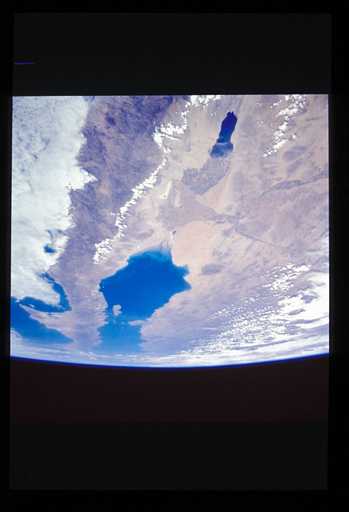
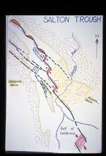
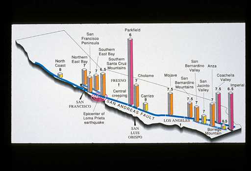
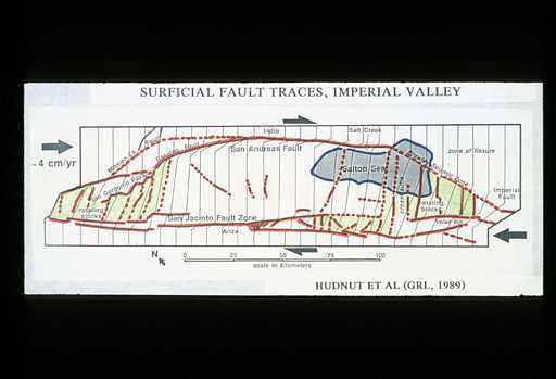
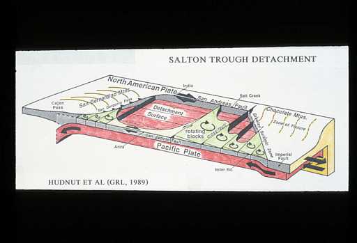
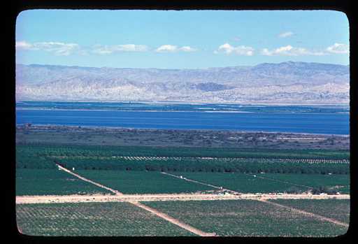
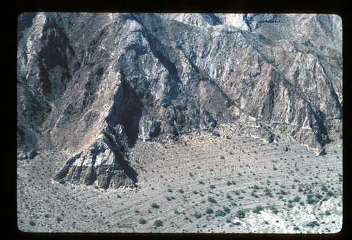
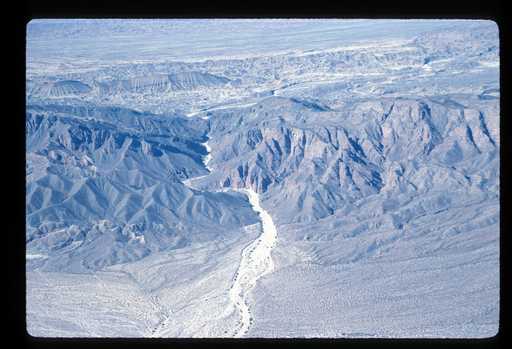
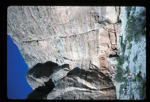
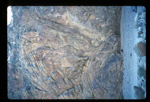
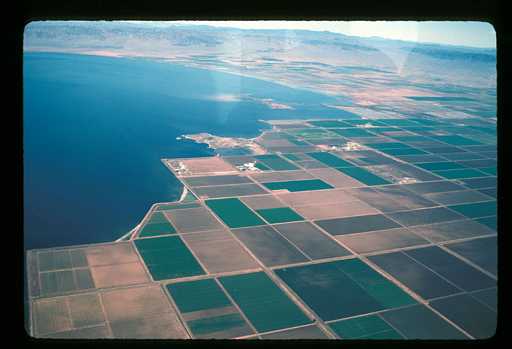
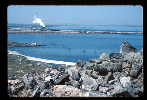
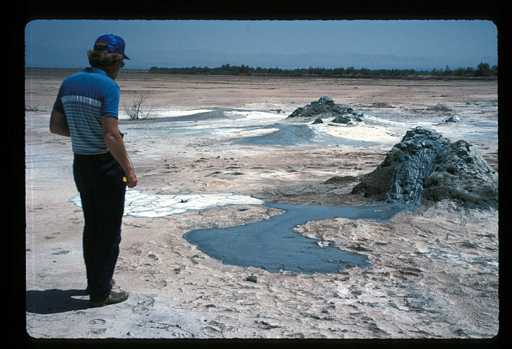
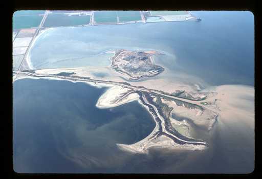
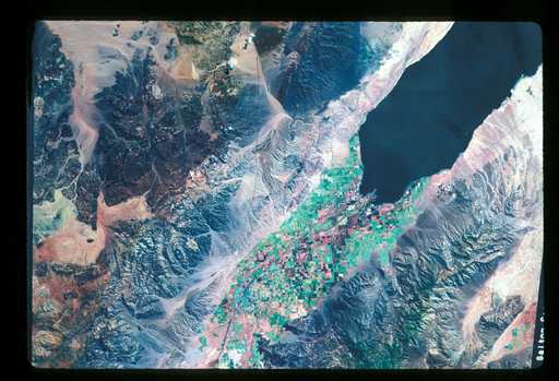
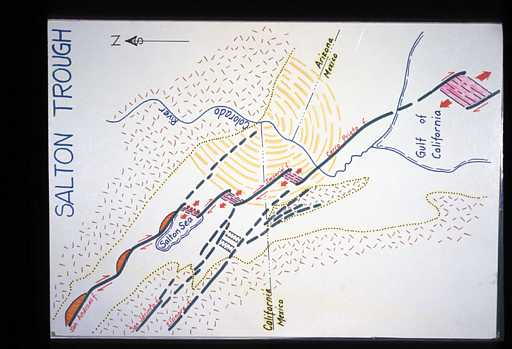
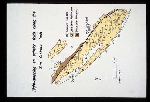
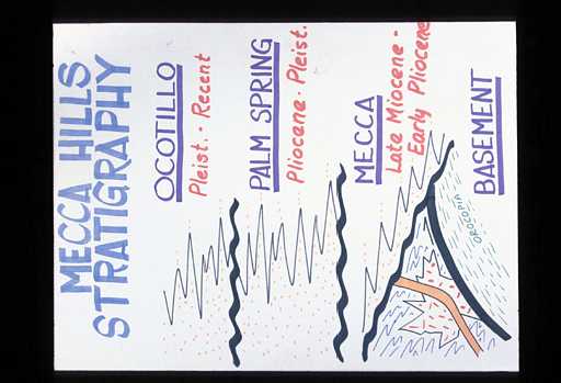
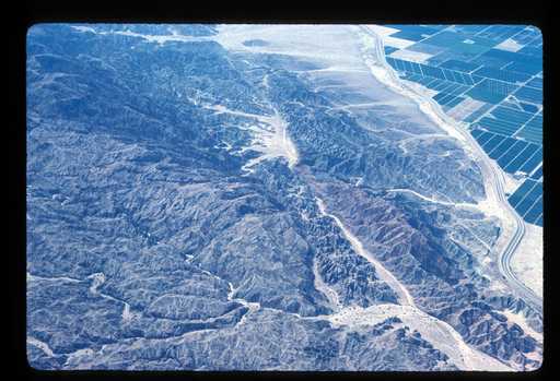
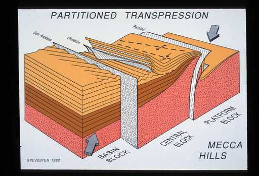
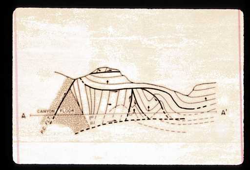
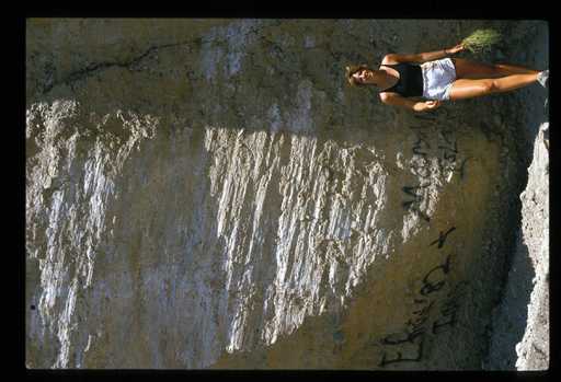
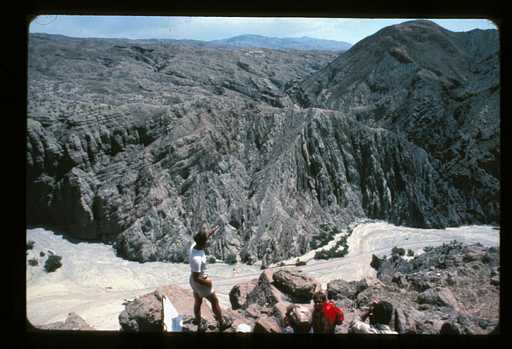
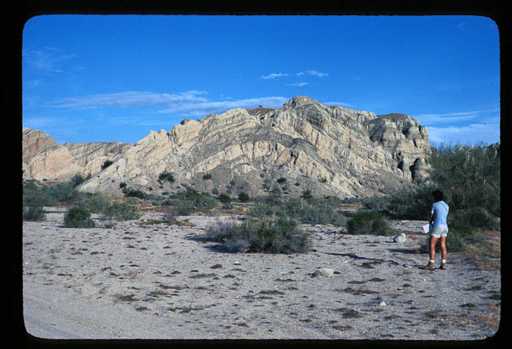
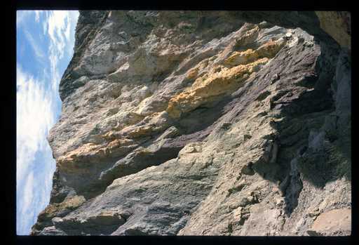
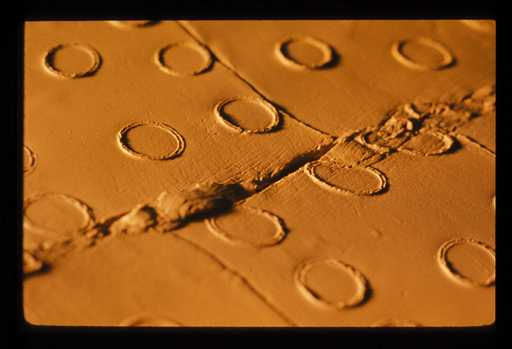
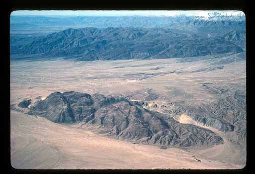
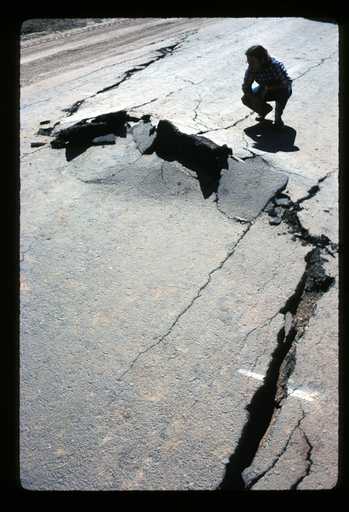
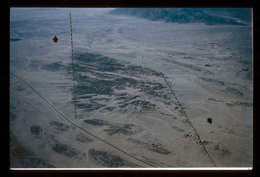
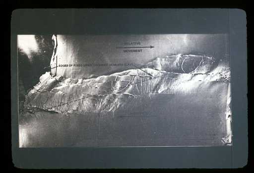
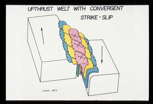
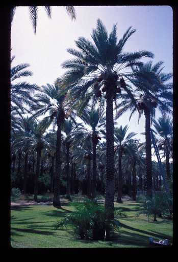
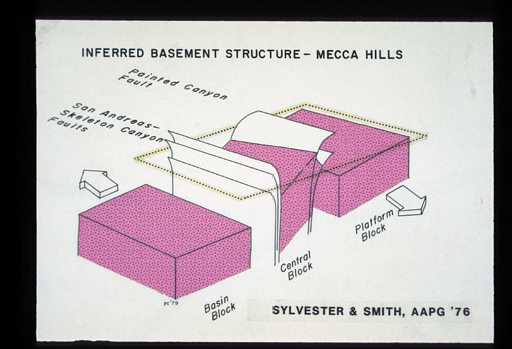
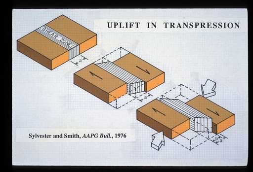
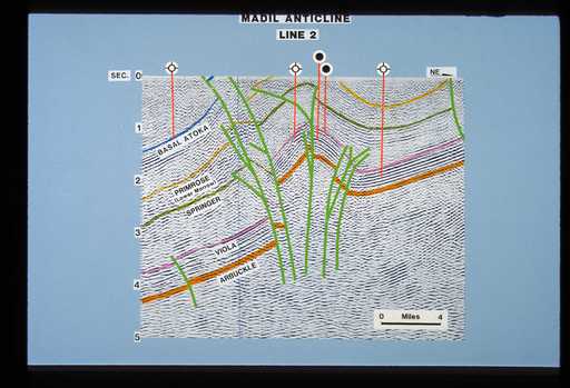
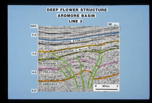
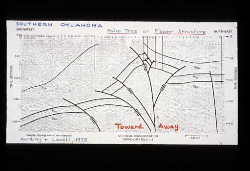
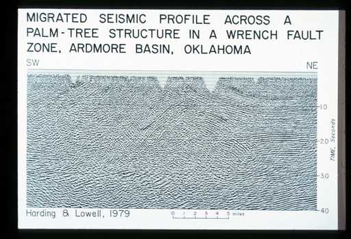
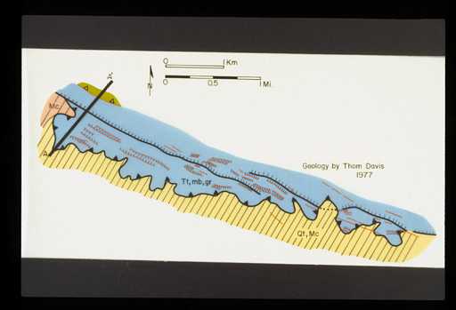
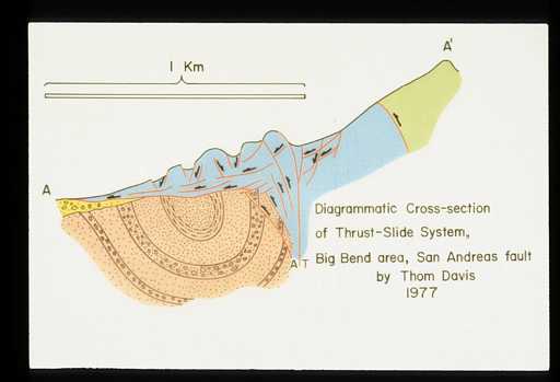
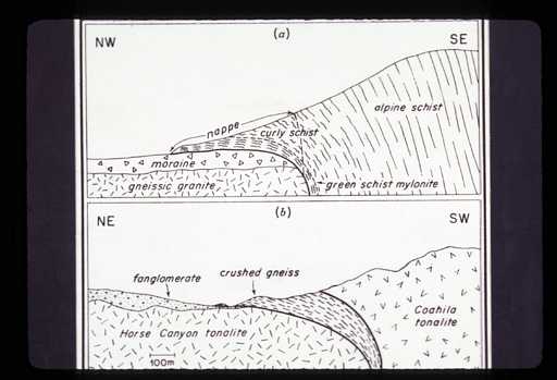
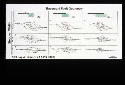
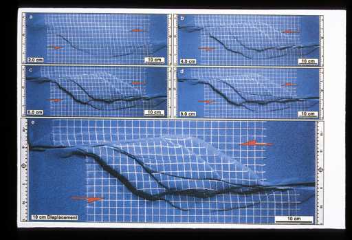
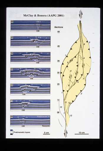
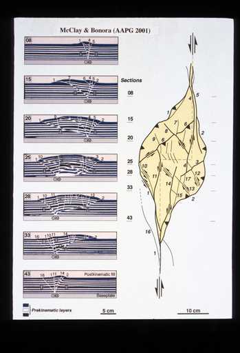
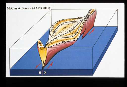
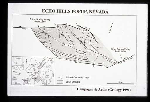
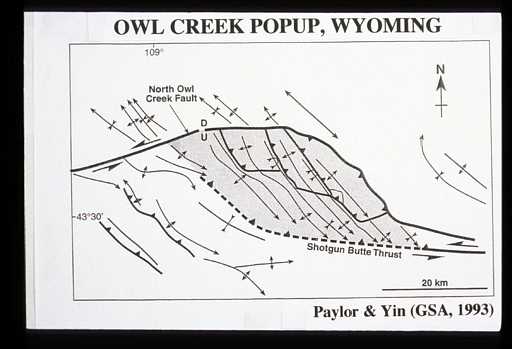
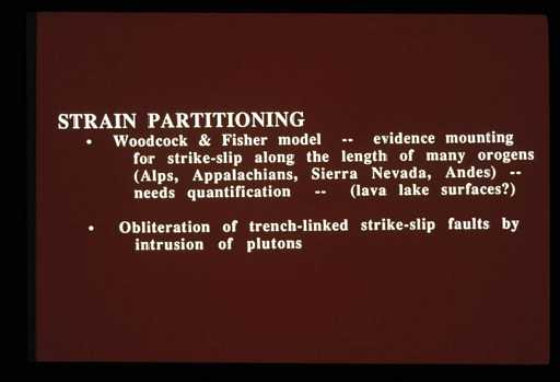
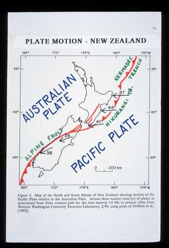
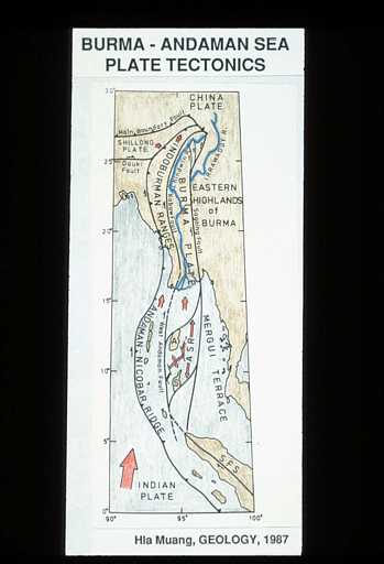
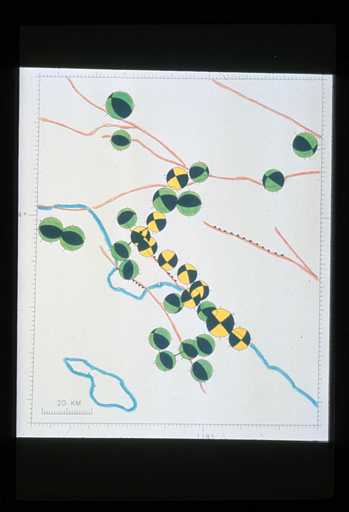
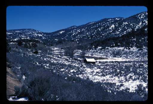
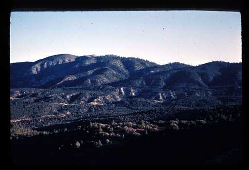
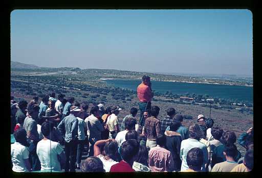
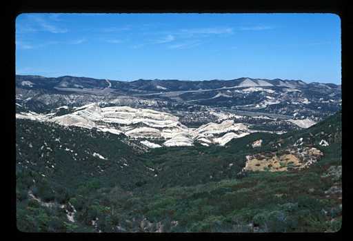
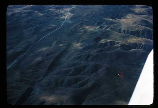
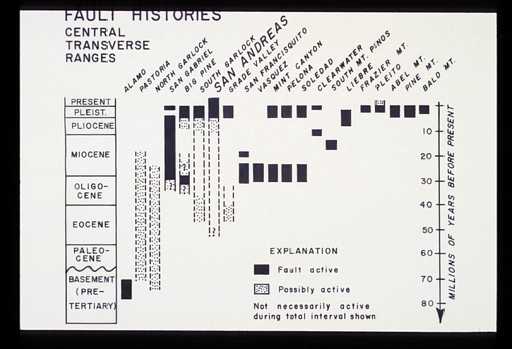
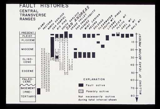
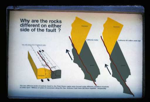
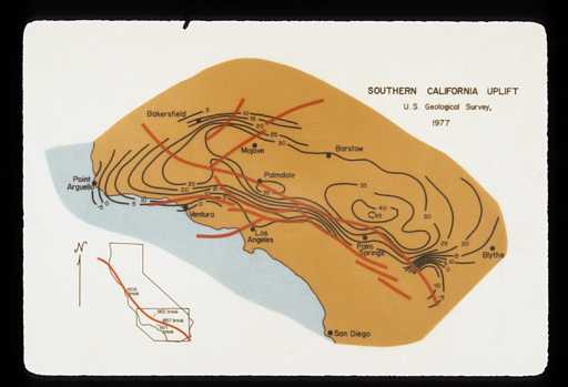
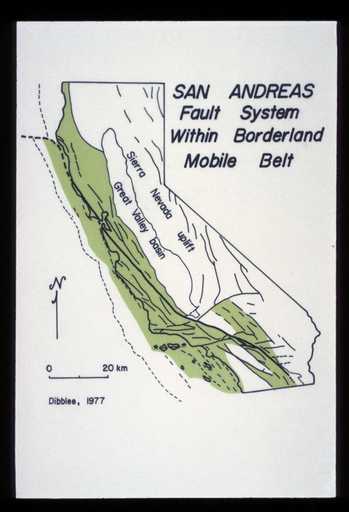
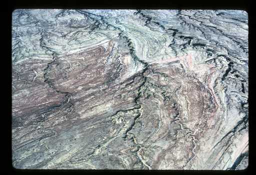
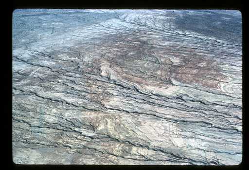
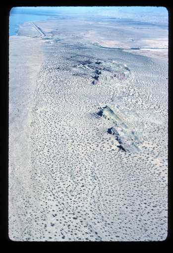
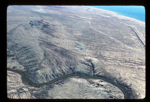
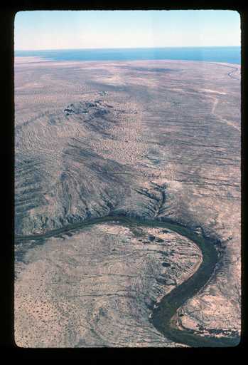
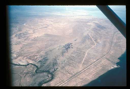
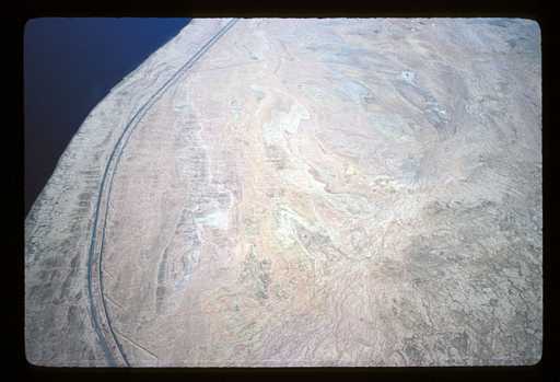
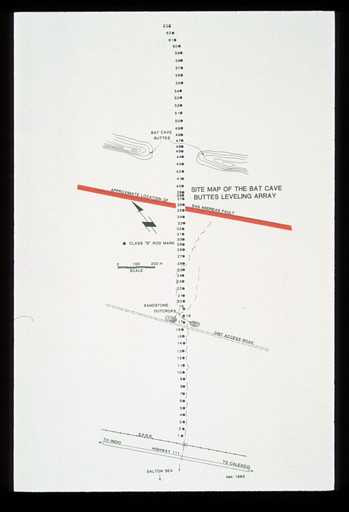
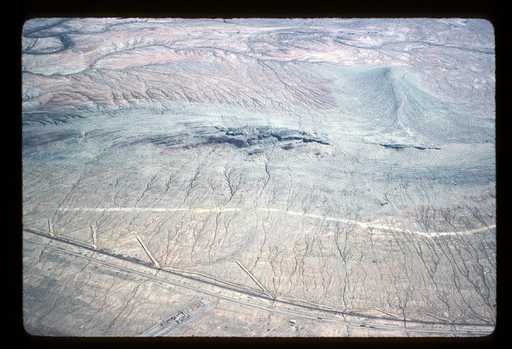
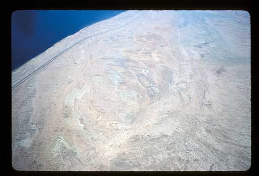
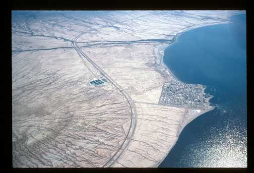
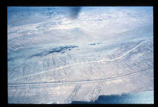
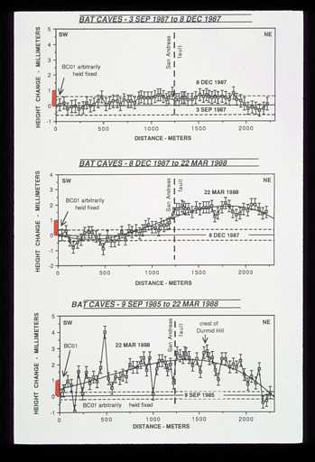
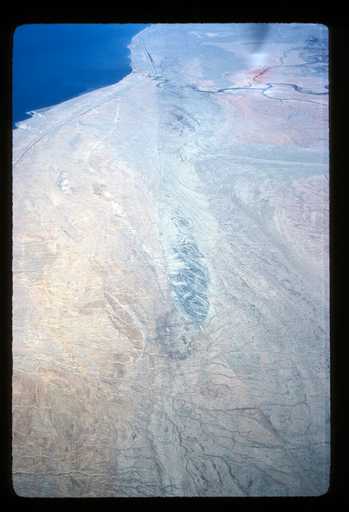
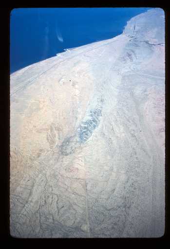
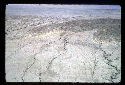
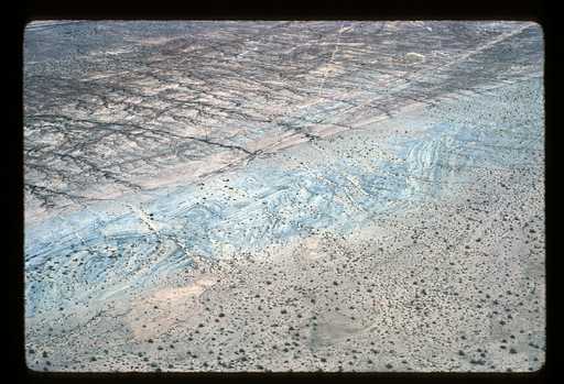
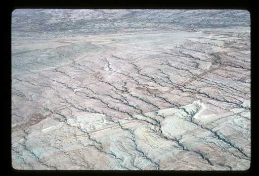
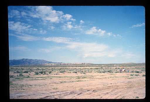
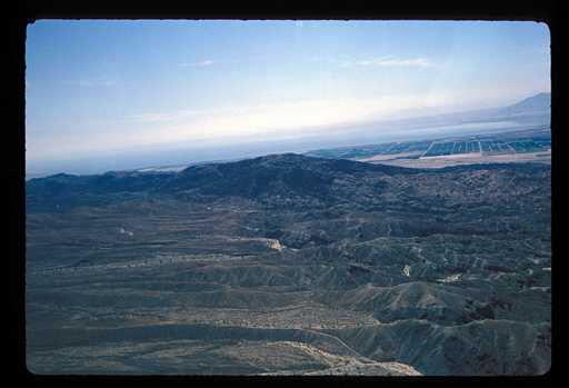
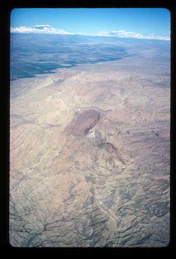
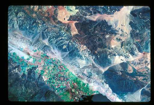
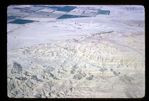
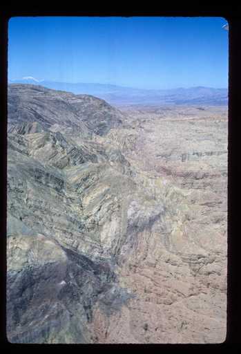
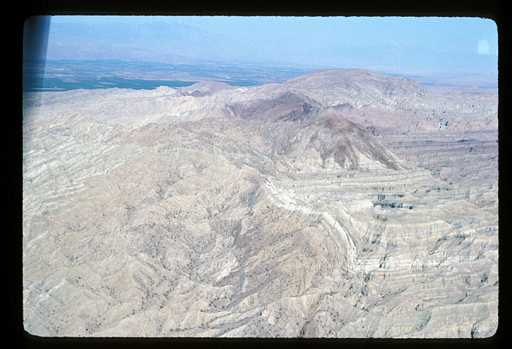
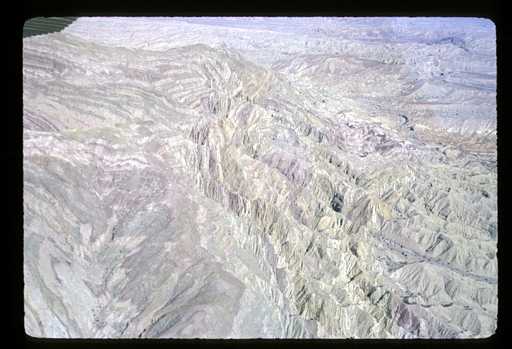
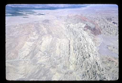
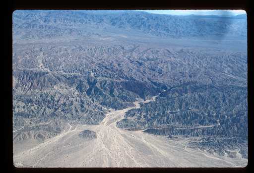
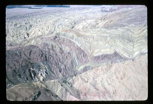
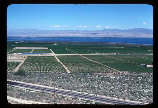
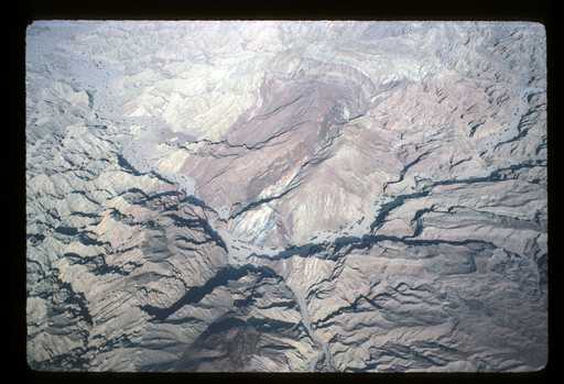
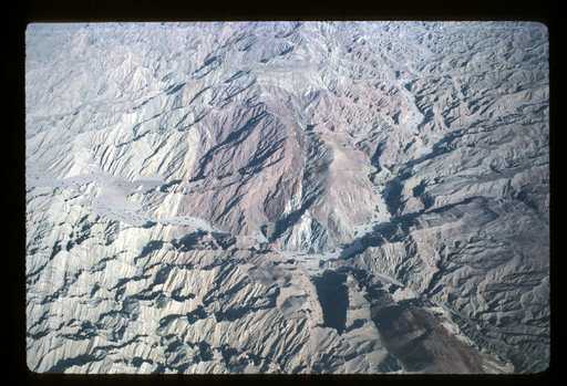
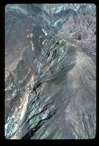
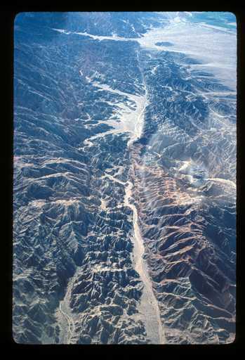
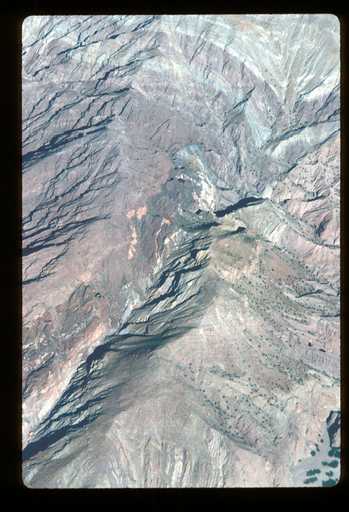
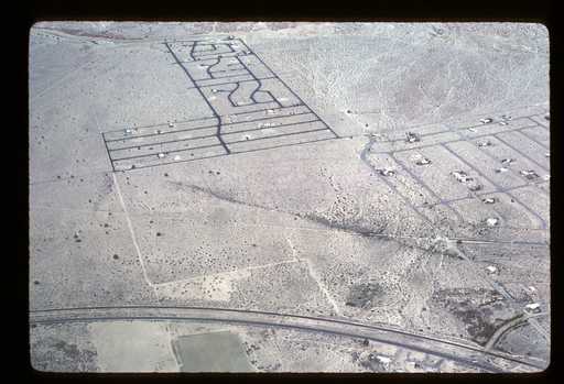
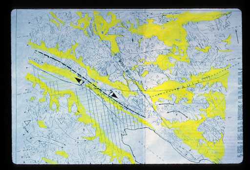
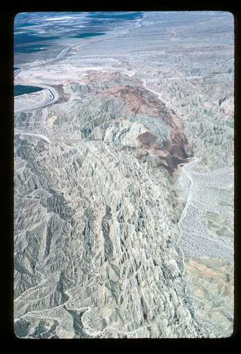
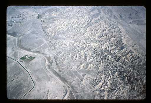
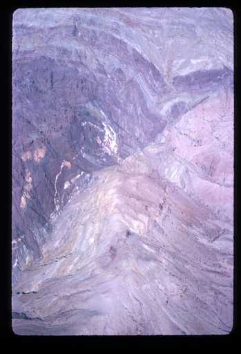
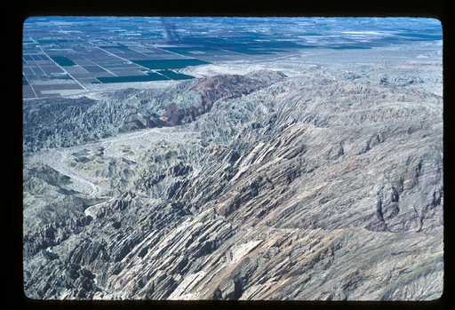
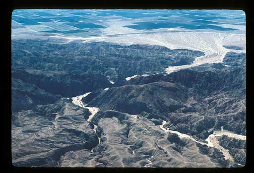
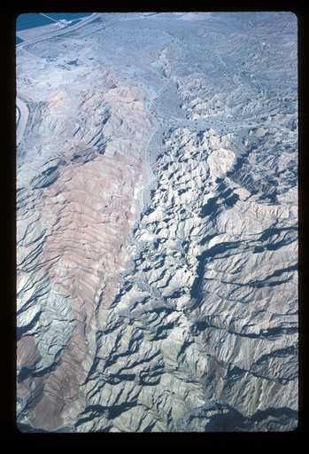
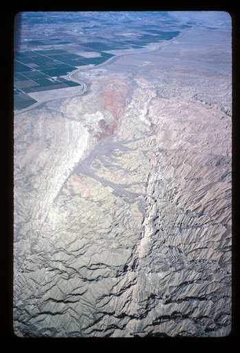
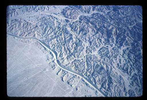
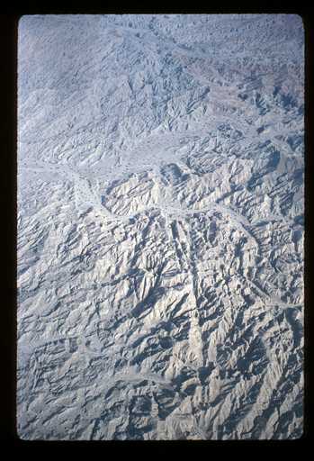
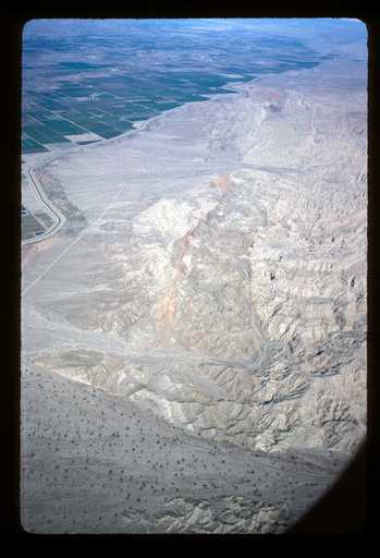
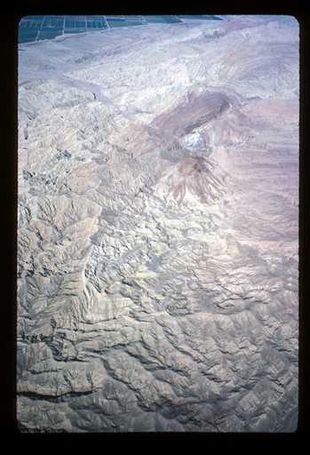
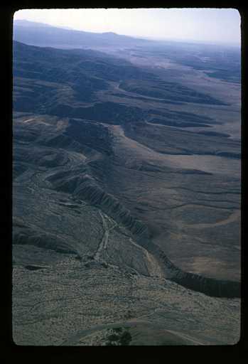
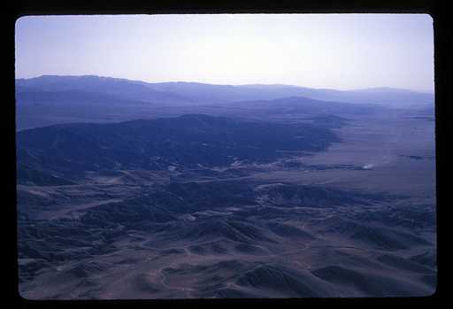
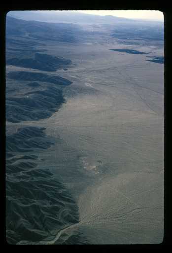
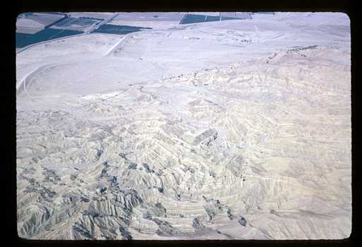
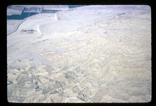
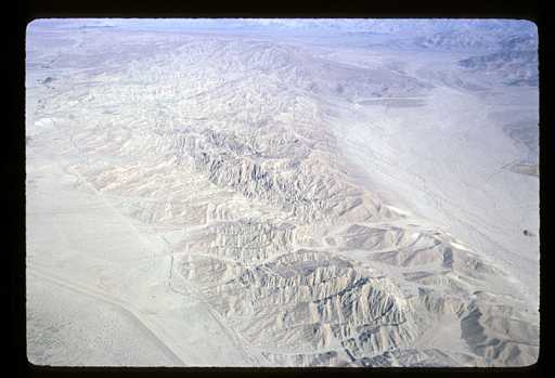
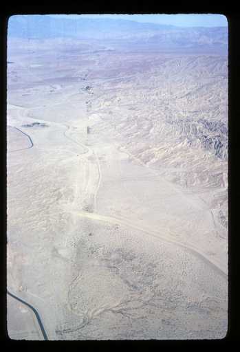
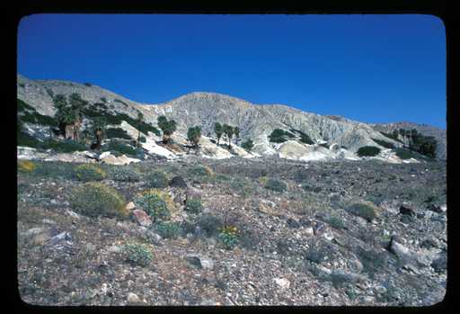
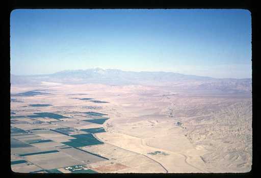
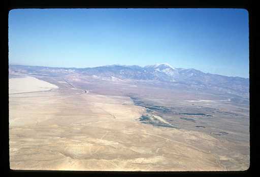
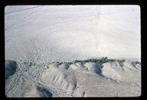
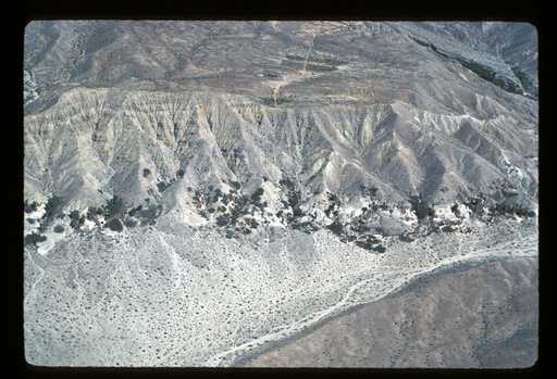
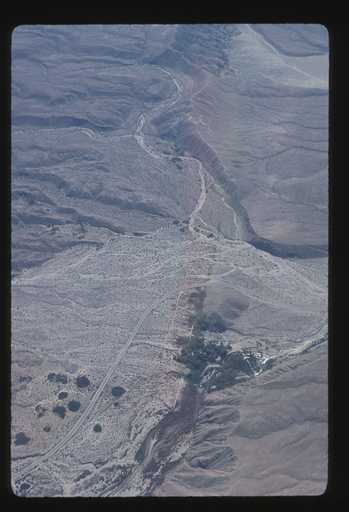
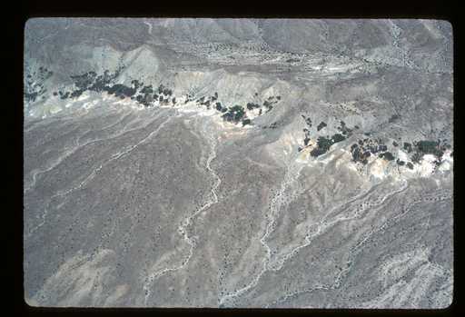
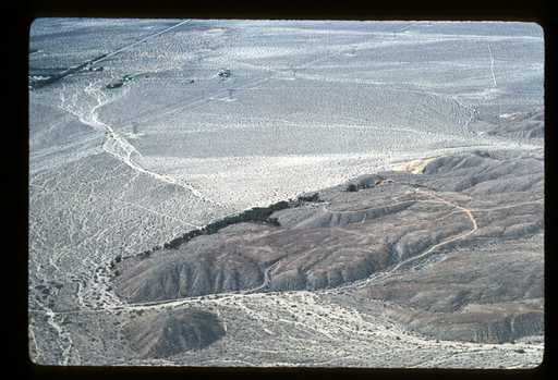
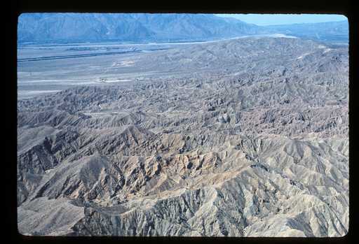
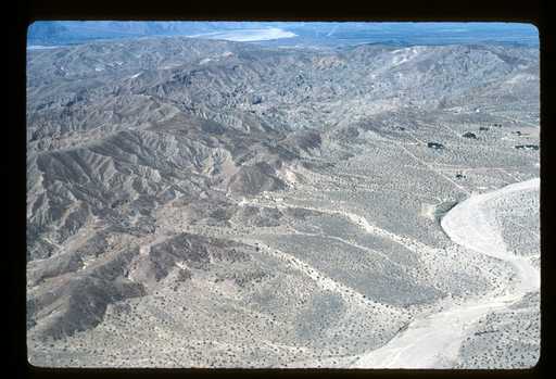
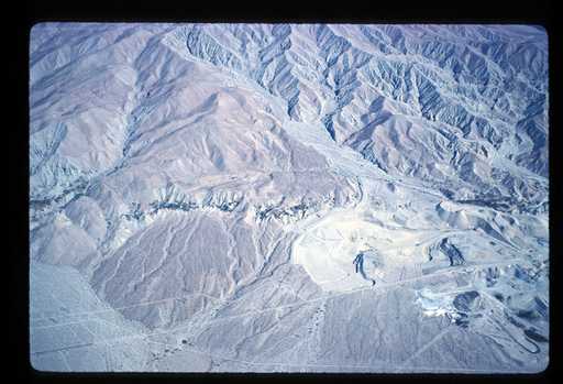
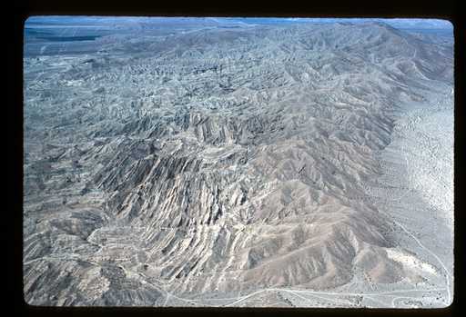
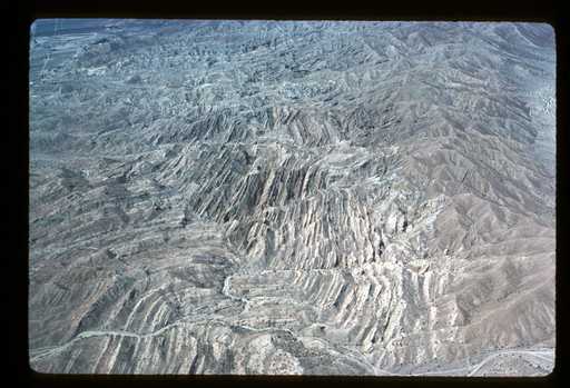
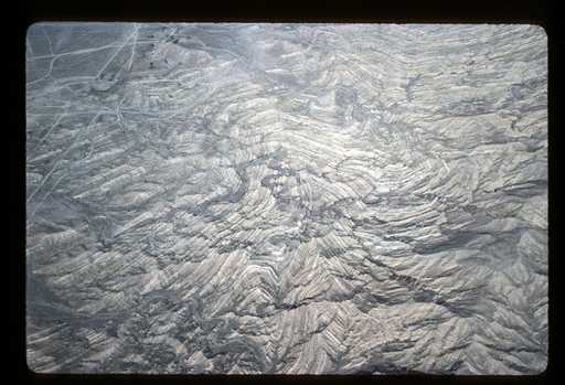
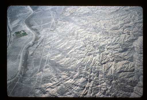
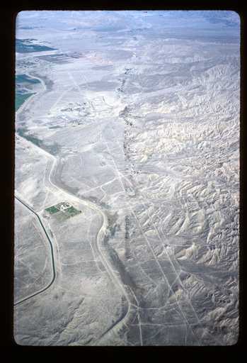
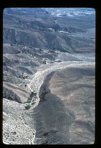
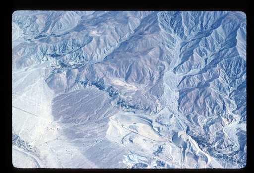
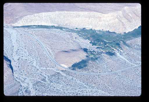
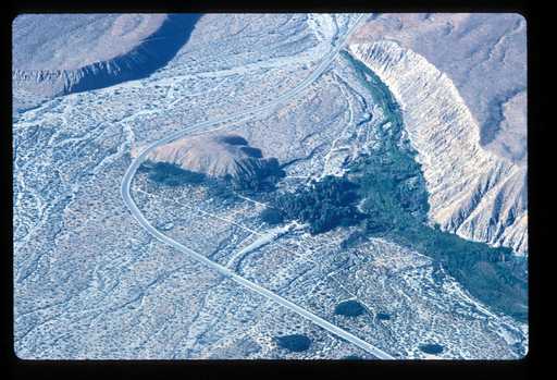
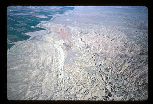
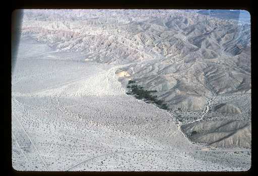
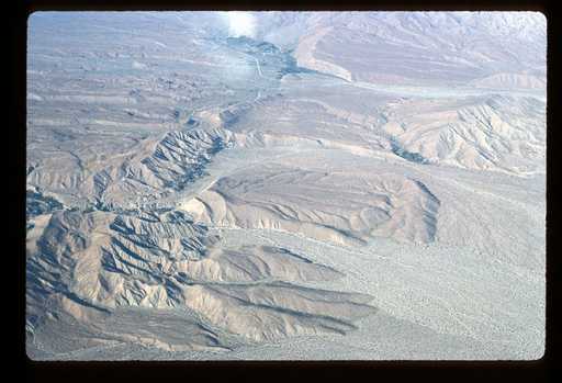
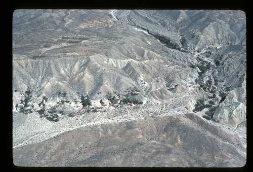
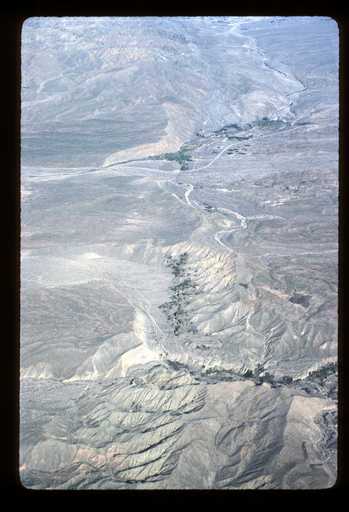
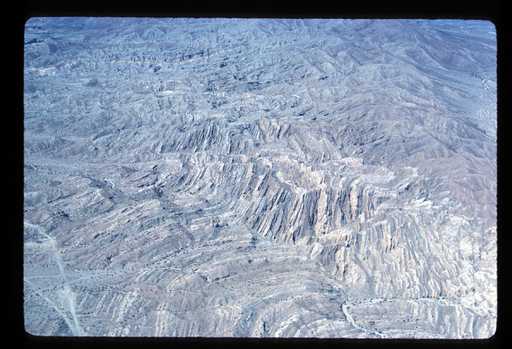
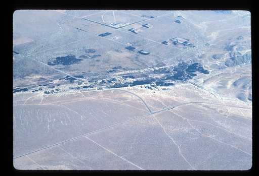
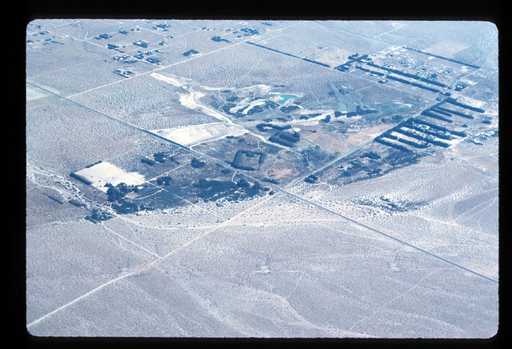
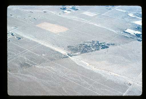
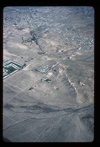
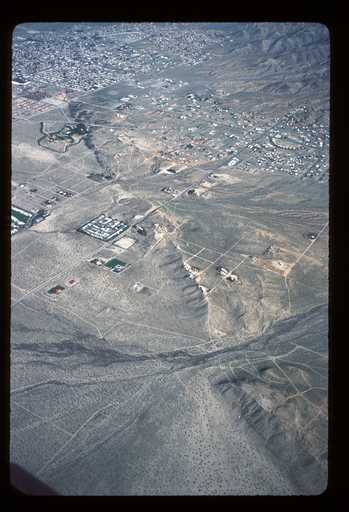
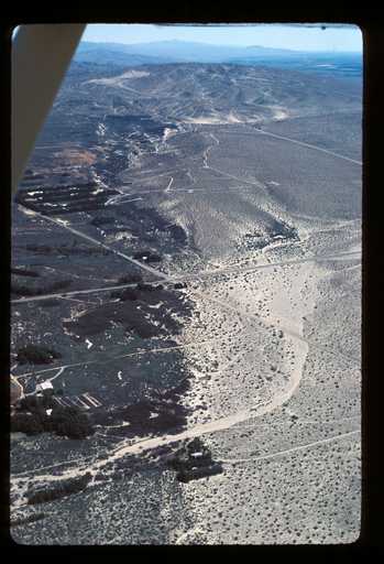
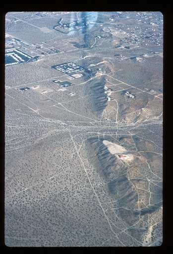
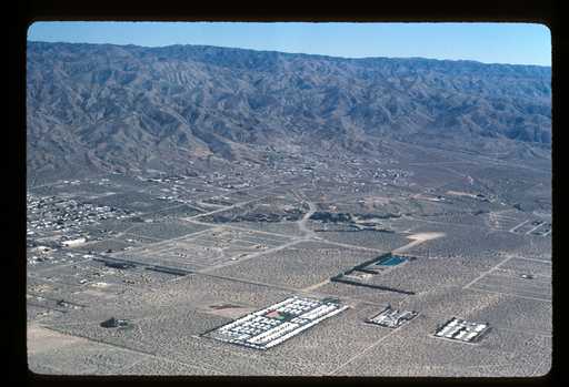
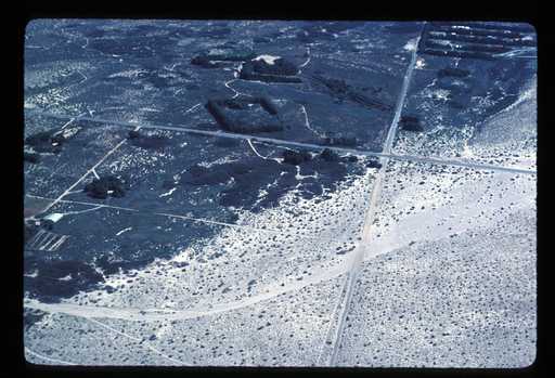
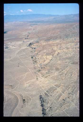
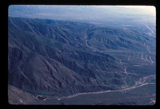
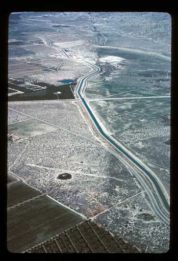
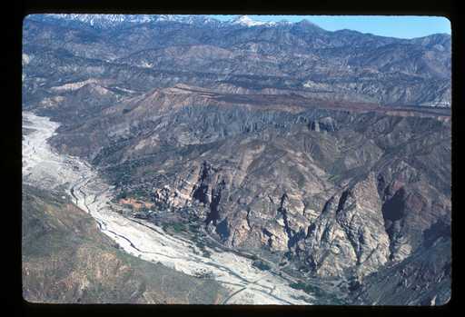
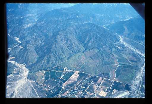
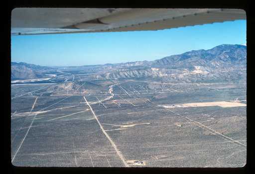
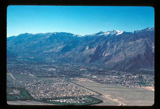
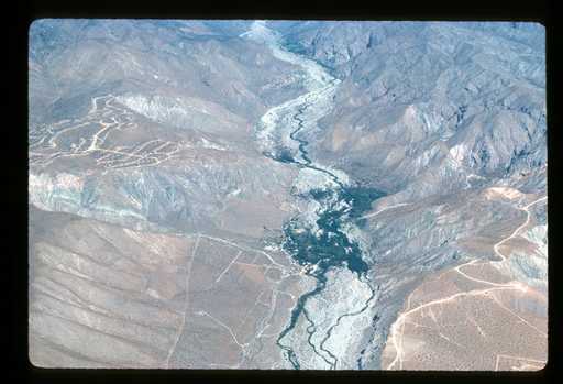
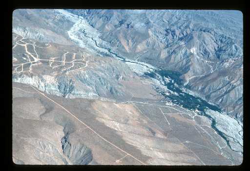
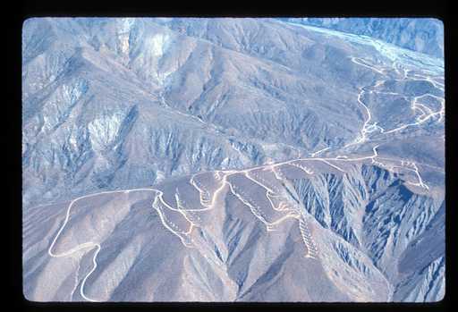
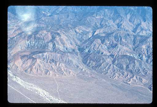
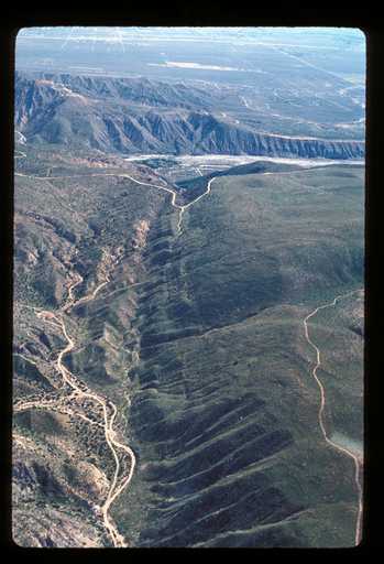
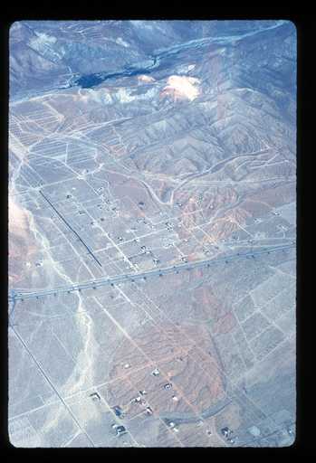
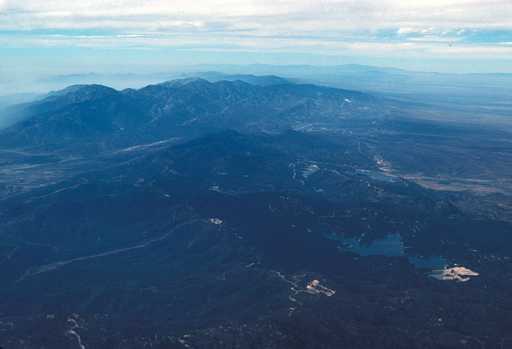
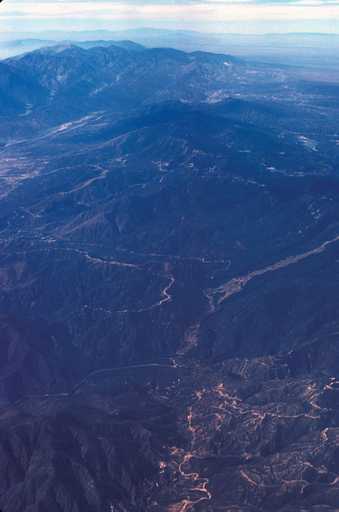
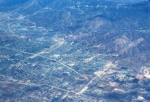
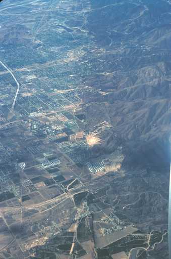
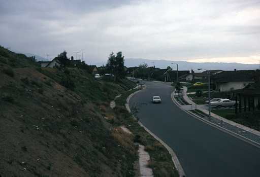
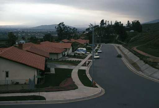
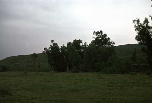
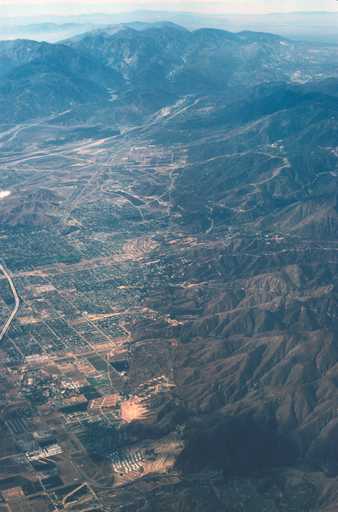
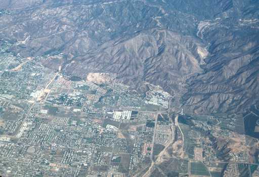
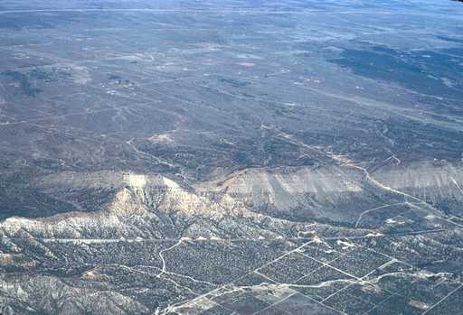
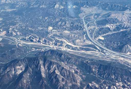
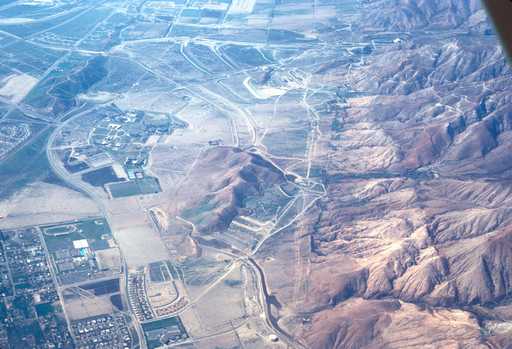
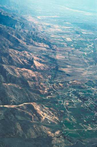
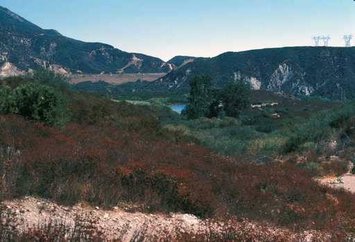
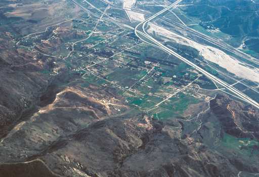
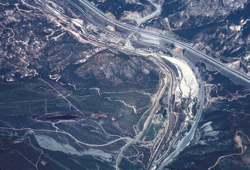
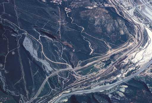
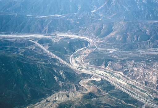
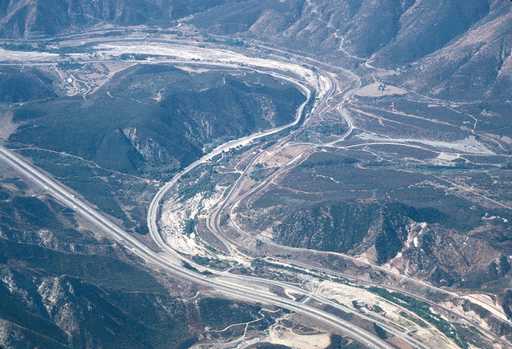
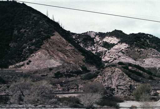
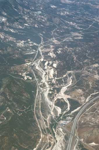
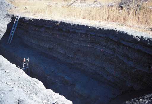
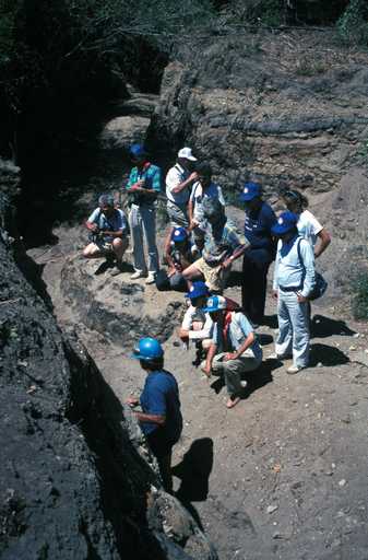
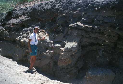
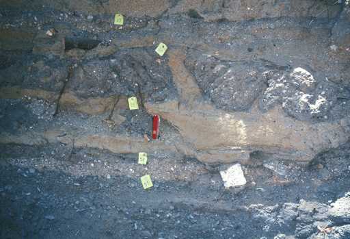
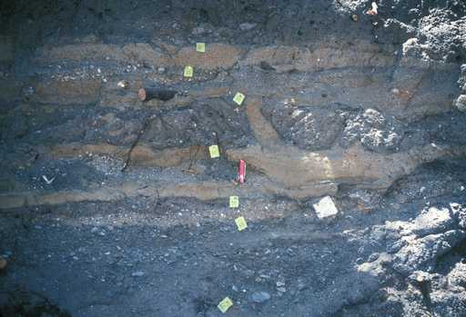
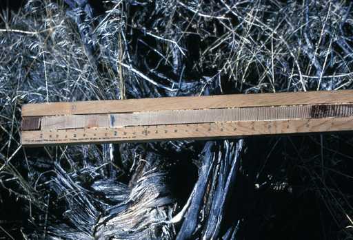
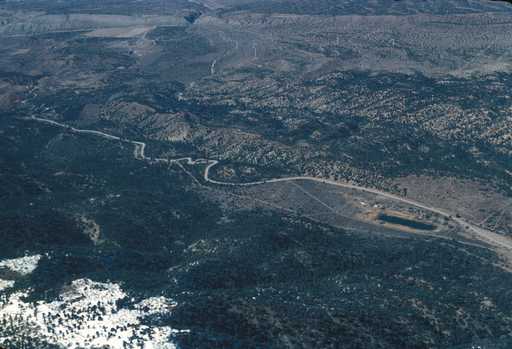
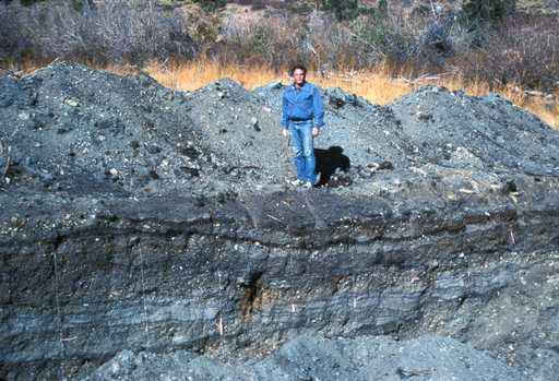
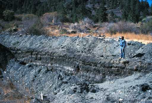
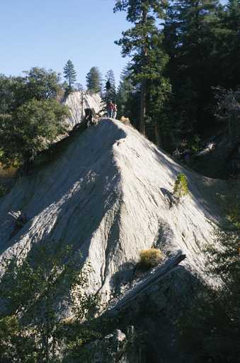
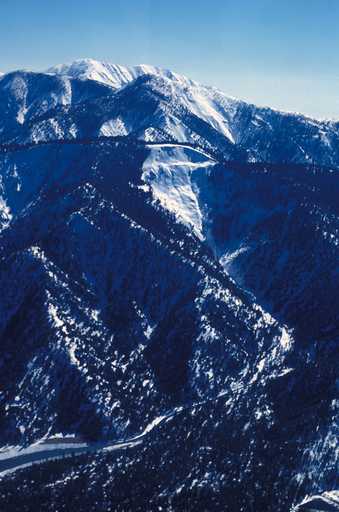
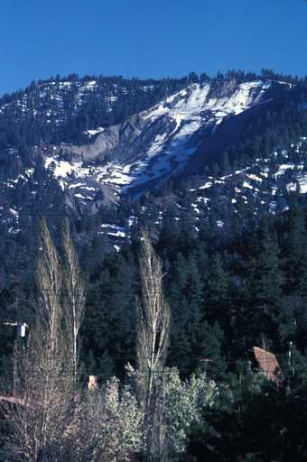
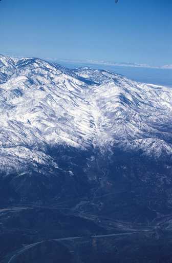
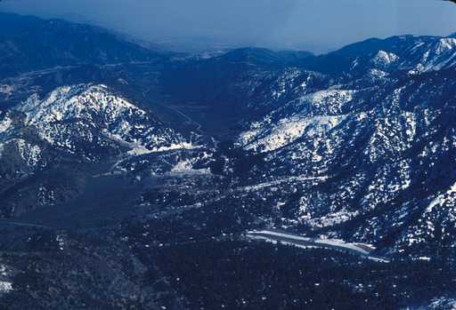
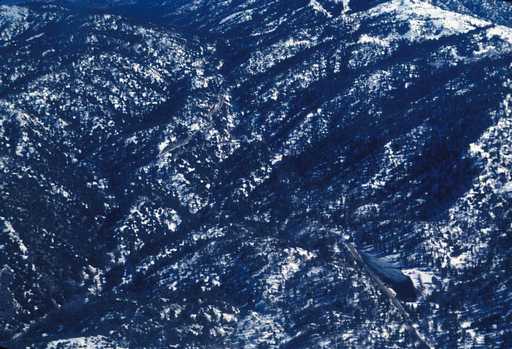
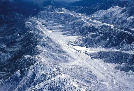
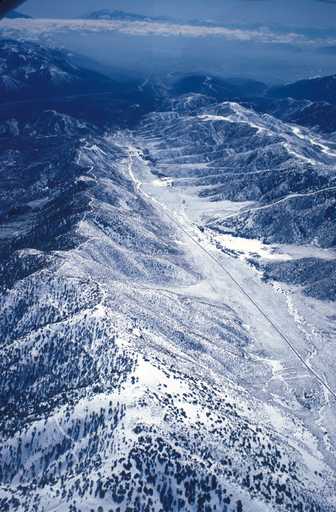
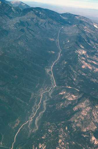
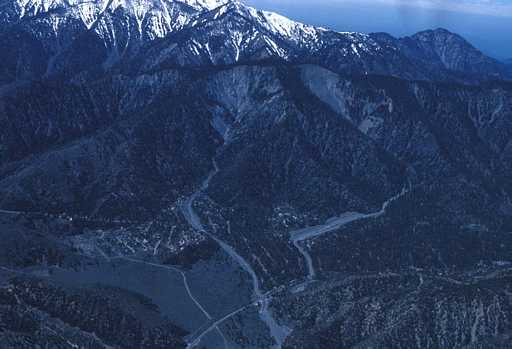
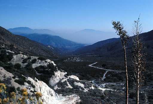
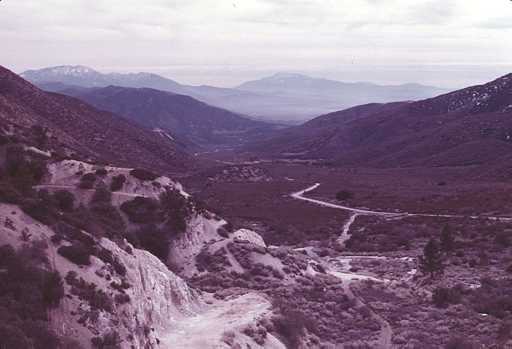
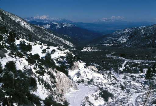
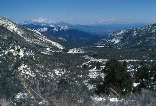
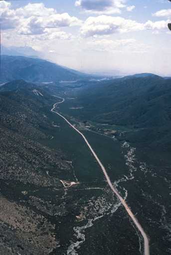
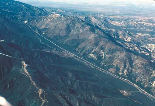
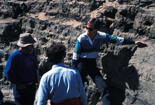
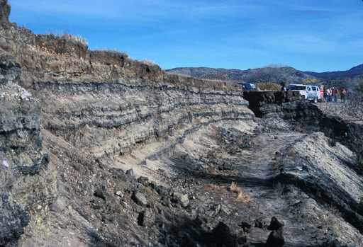
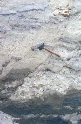
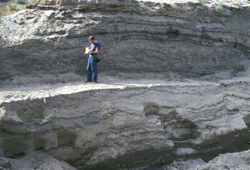
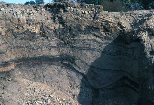
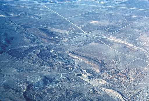
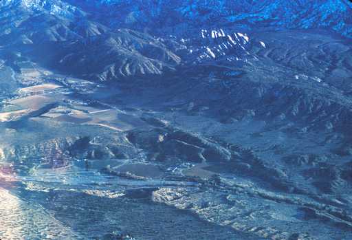
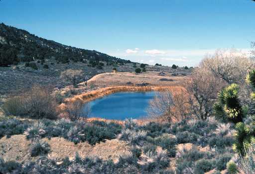
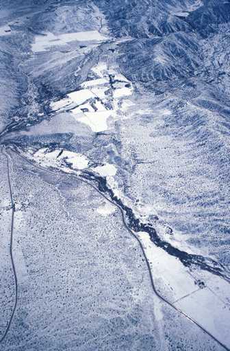
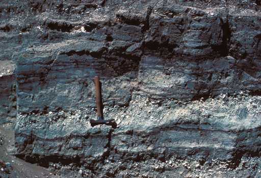
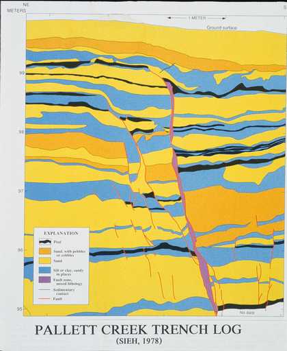
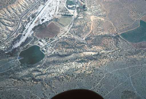
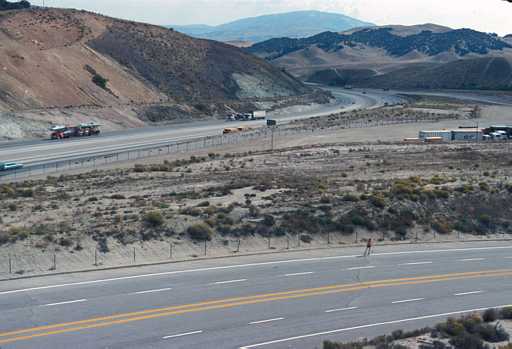
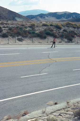
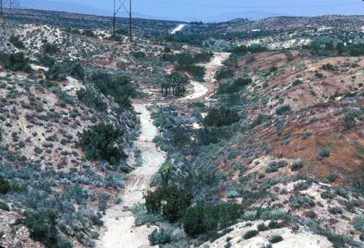
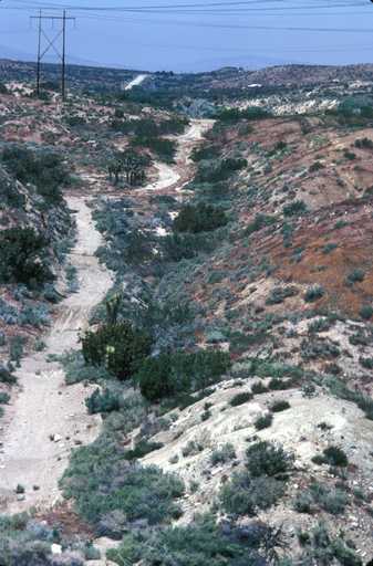
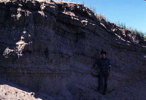
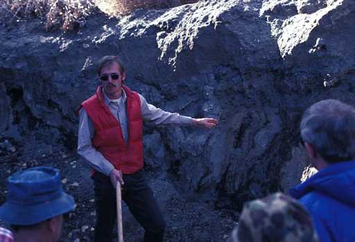
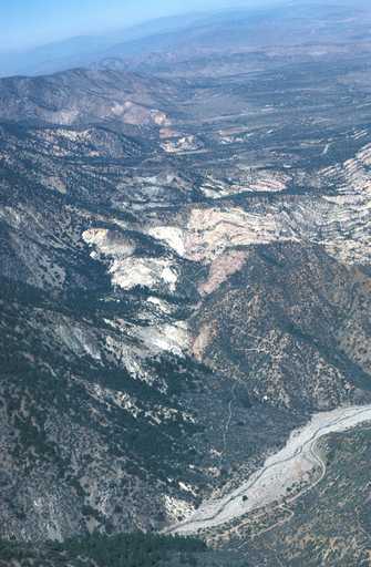
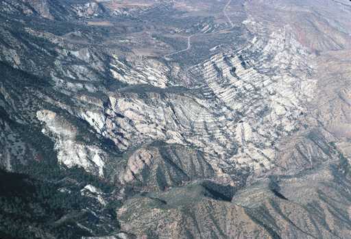
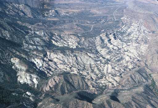
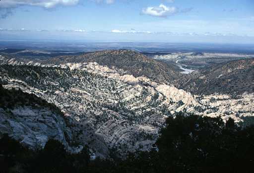
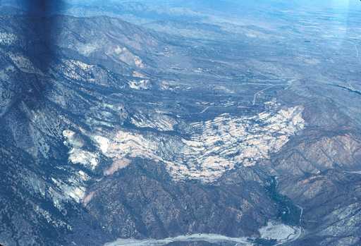
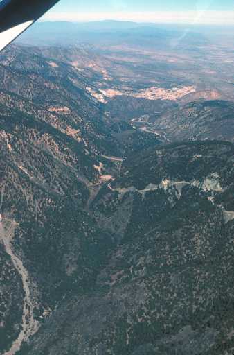
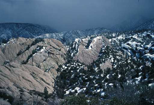
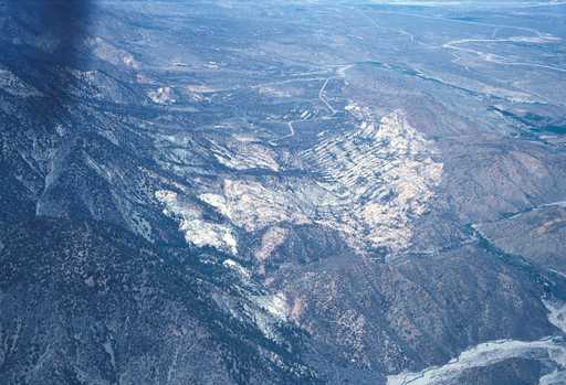
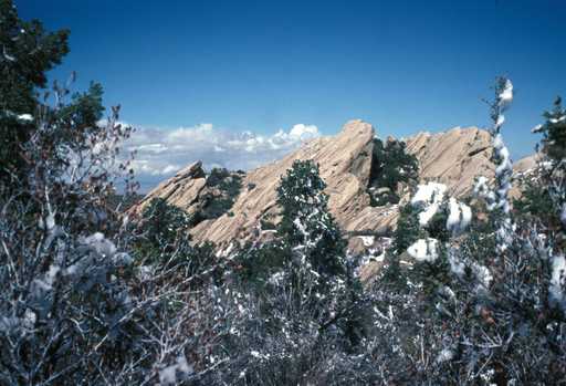
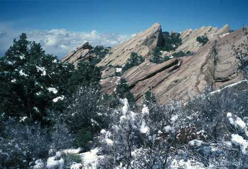
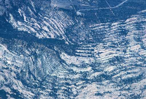
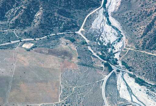
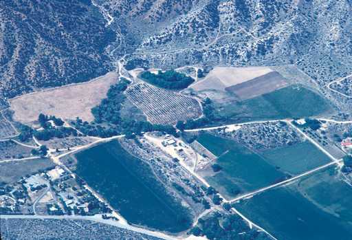
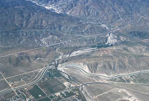
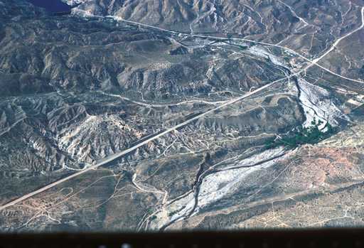
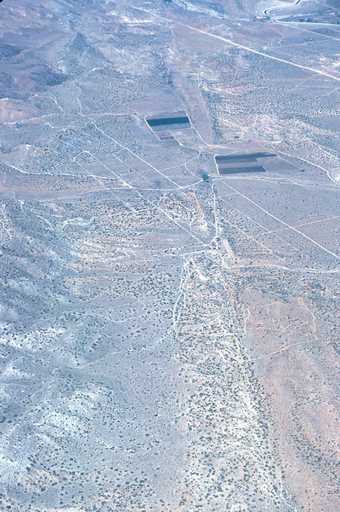
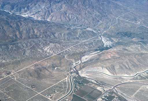
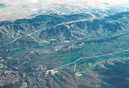
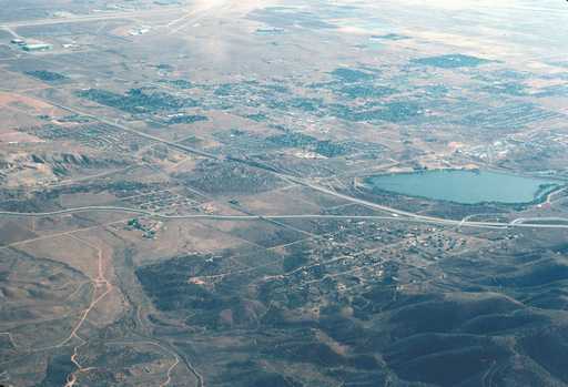
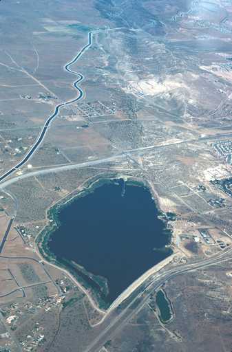
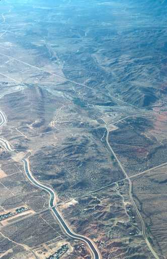
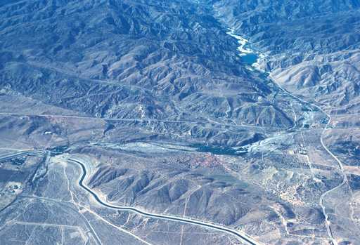
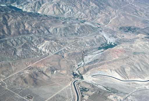
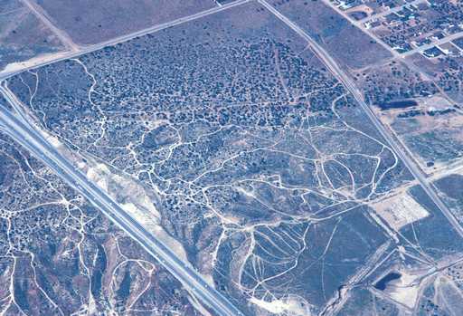
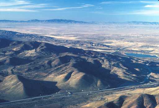
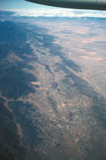
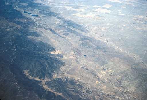
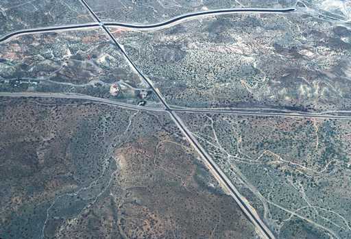
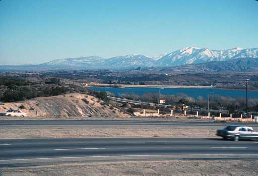
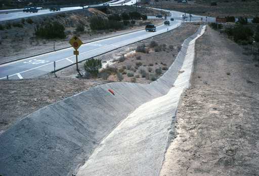
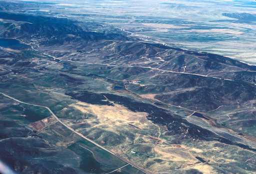
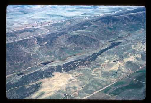
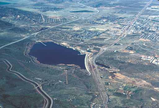
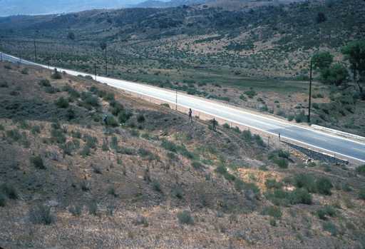
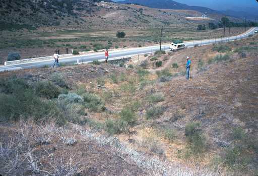
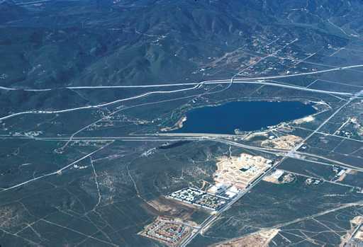
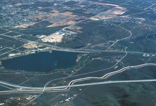
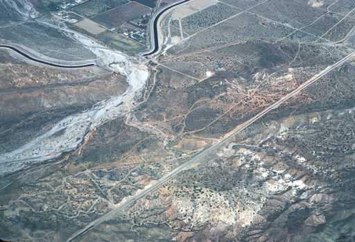
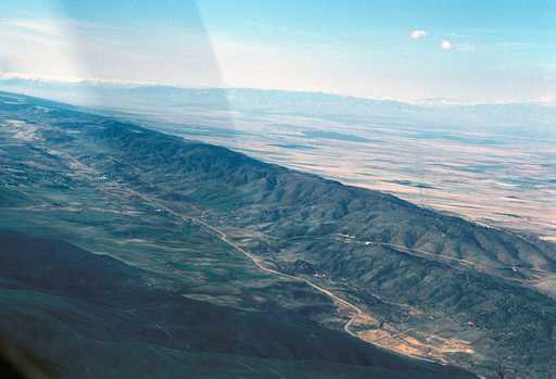
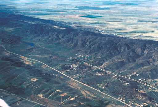
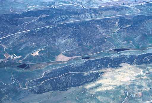
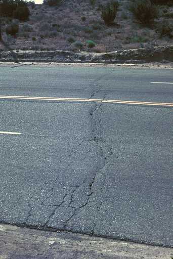
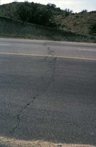
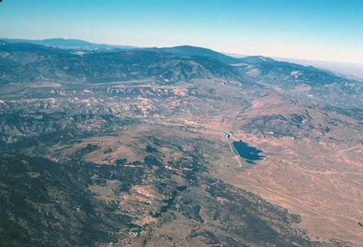
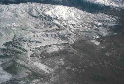
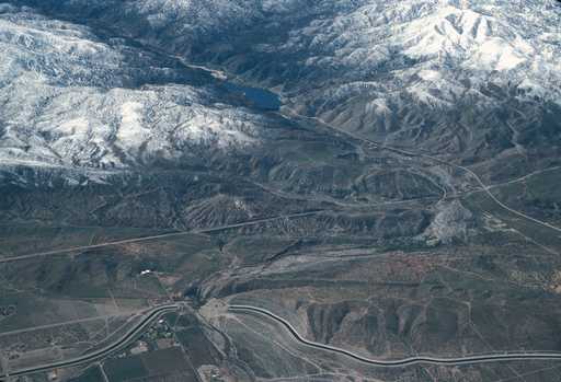
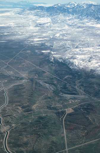
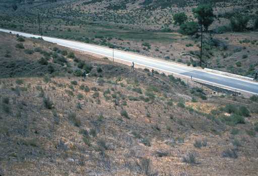
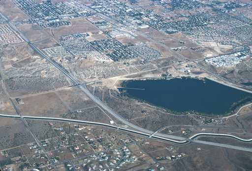
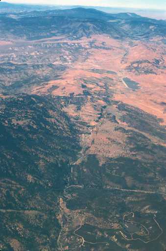
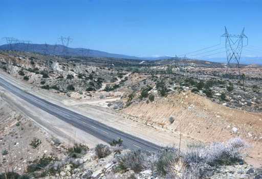
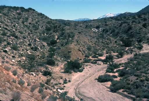
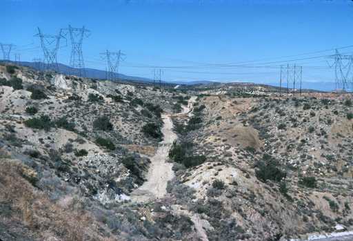
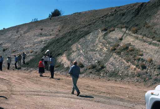
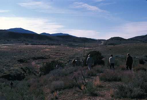
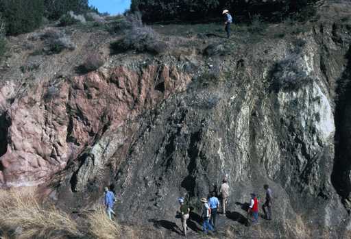
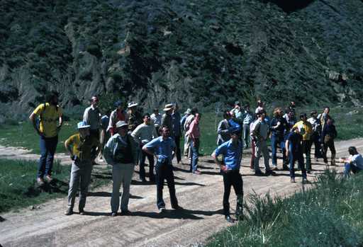
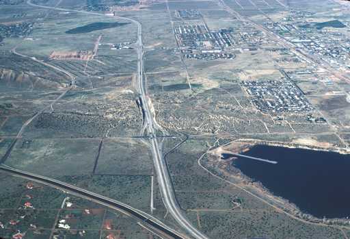
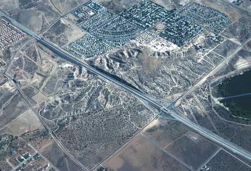
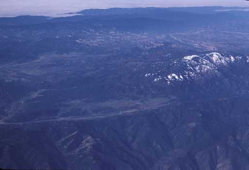
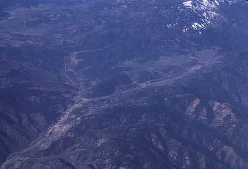
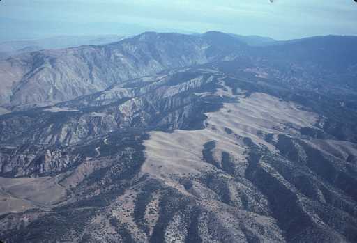
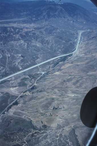
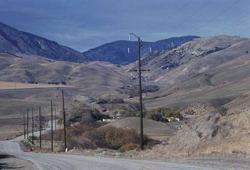
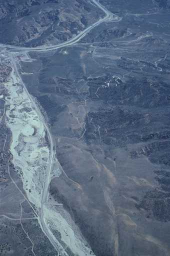
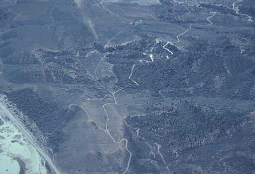
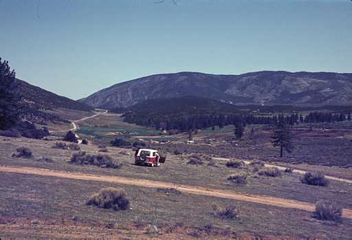
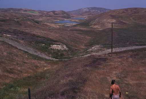
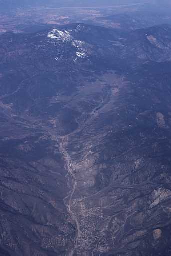
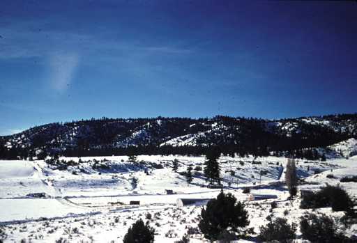
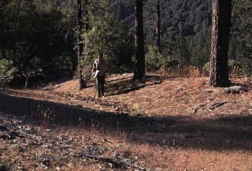
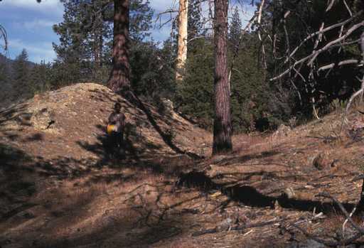
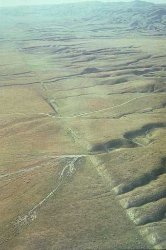
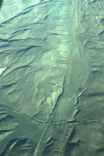
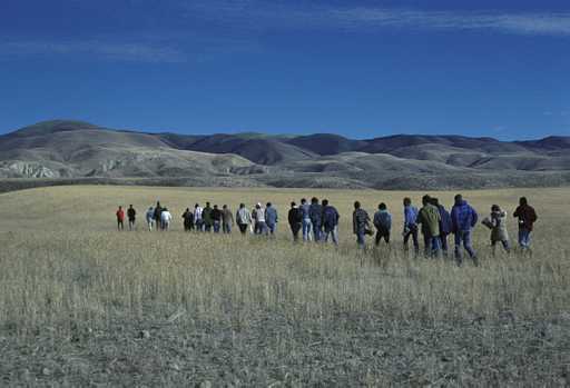
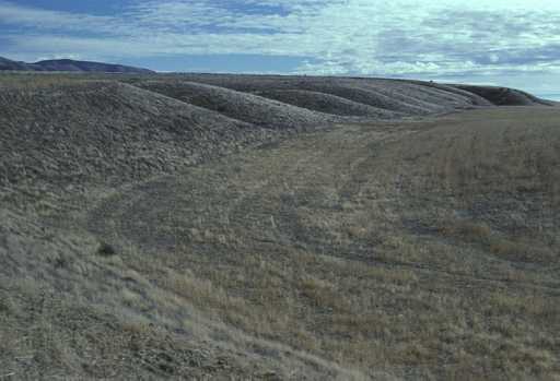
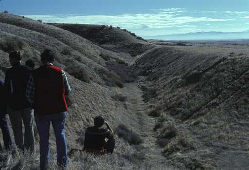
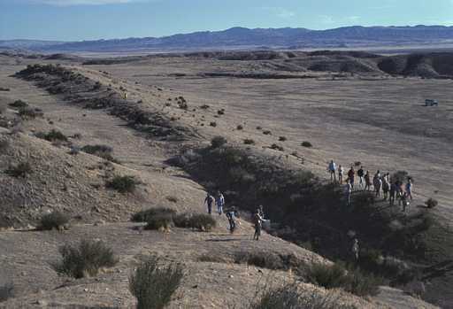
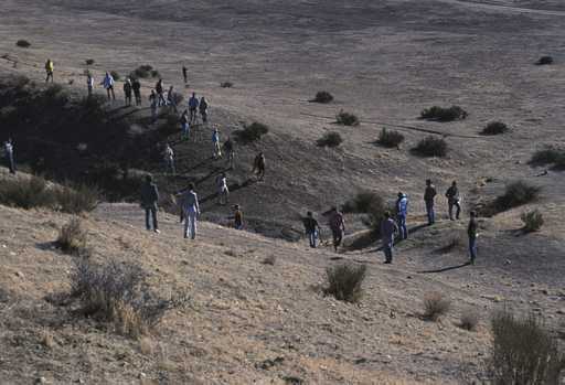
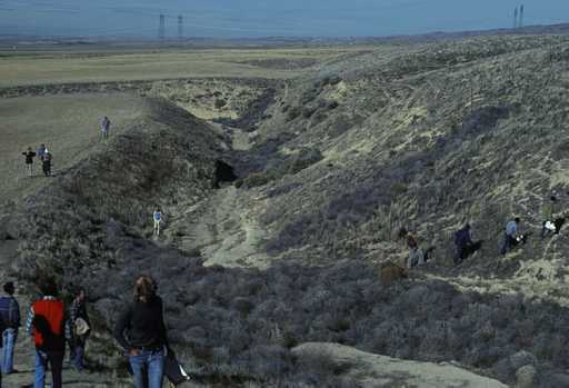
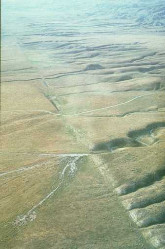
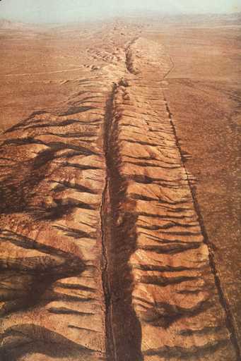
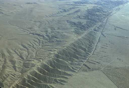
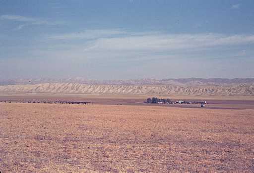
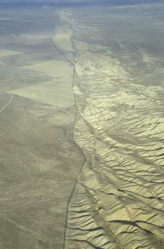
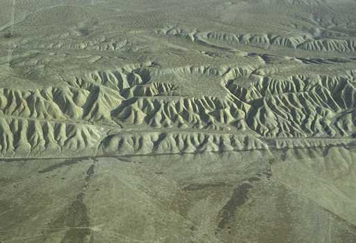
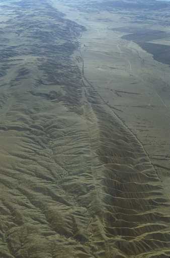
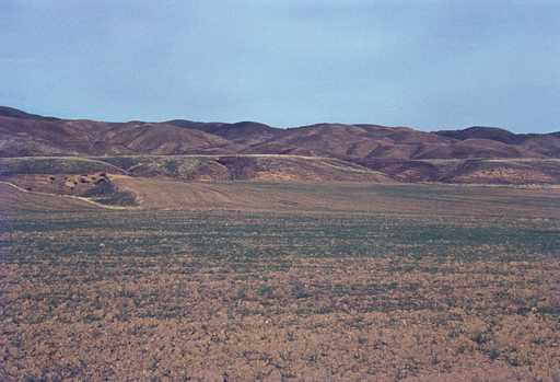
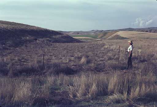
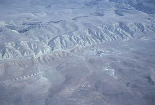
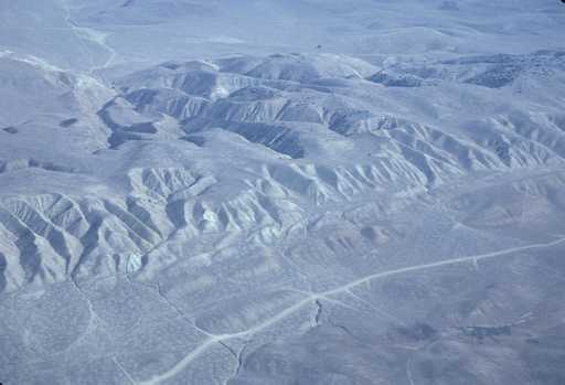
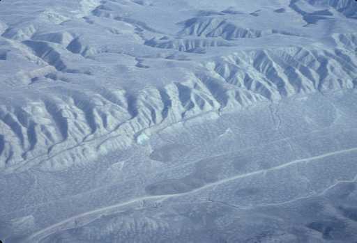
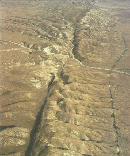